Solar Powered GPS Receiver Array - Wilbur, WA
Posted by:  T0SHEA
N 47° 45.548 W 118° 44.727
11T E 369194 N 5291004
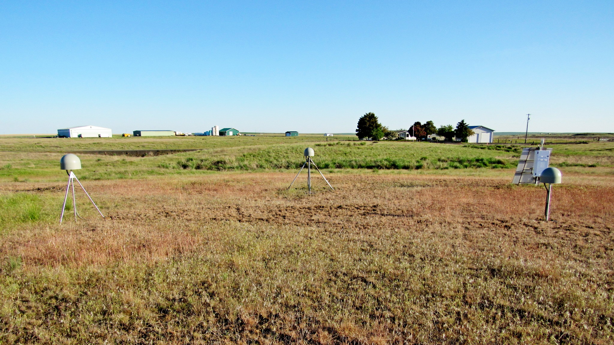
Known as a Height Modernization Survey Station, this is an array of three GPS receivers near the Wilbur Airport.
Waymark Code: WMYJR4
Location: Washington, United States
Date Posted: 06/21/2018
Views: 1
The array consists of three antennas arrayed in a triangle about 40 feet on each side. In an open area of grass and sagebrush, these antennas stand well away from multipath interference from buildings and other large objects. They are about 150 feet south of Highway 2,
140 feet north of Wilbur Airport Road and about 1.5 miles west of the town of Wilbur. Located well away from available electricity, they are powered by a solar array of about 35 to 40 square feet in surface area. The system was installed October 1, 2005.
Along with the solar panels are storage batteries and electronics for telemetry to relay data to a central collection point.