
There's a direction and distance post, one of hundred start or finish trailheads of the 'Bodensee-Rundwanderweg' (Lake Constance Trail) - located beside the pilgrimage church of Birnau, Baden-Württemberg, Germany.
Bodensee-Rundwanderweg
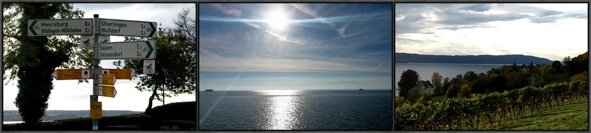
The Lake Constance Trail, signposted as 'Bodensee-Rundweg', leads around Lake Constance through the state areas of Germany, Austria and Switzerland. The trail has no start or finish trailhead, but at the given coordinates beside the pilgrimage church of Birnau, this waymark is marking the point were the trail was consecrated on October 25th, 1970 as the fourth international long-distance trail in Europe. Hiking associations from Germany, Austria and Switzerland drew the way in the 1960s and the aim was to provide visitors with a range of hiking opportunities for visitors to the recreational resorts along the lake. The originally excellent trail has a length of 256 kilometers.
Not all banks are accessible because of the industrial settlements, buildings and nature reserves. Then the trail runs around these zones. Also in the estuary of rivers, for example Leiblach, Bregenzerhauer, canalized Rhine, and Alter Rhein, sometimes considerable distances have to be laid back up to the next bridge or border crossing point. Sometimes the Lake Constance circular route is a mountain path due to traffic-rich shores or because of the viewing possibilities. The marking of the Lake Constance Trail is a right-angled arrow around a blue point. In Switzerland, the partial targets are indicated on yellow-colored signposts. The inscription is often reduced to "Wanderweg".
source: [DE] Wikipedia