|
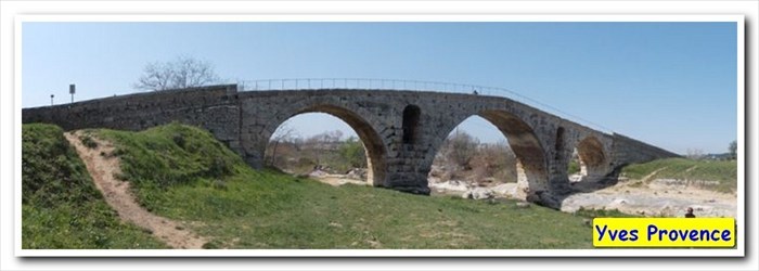
 Le Pont Julien - Bonnieux, Paca, France
N 43° 51.786 E 005° 18.384
31T E 685340 N 4859253
Le Pont Julien est un pont romain, traditionnellement daté de l'an 3 av. J.-C., au débouché du défilé de Roquefure, à 5 km au nord de Bonnieux (Vaucluse, sud de la France) et à 8 km à l'ouest de la ville d'Apt.
Waymark Code: WMWEN1
Location: Provence-Alpes-Côte d'Azur, France
Date Posted: 08/24/2017
Views: 8
Physical Location (city, county, etc.): Bonnieux, Paca, France

Road, Highway, Street, etc.: Old D108
Water or other terrain spanned: The Calavon River
Architect/Builder: Unknow
Construction Date: - 3 avant JC
|
Visit Instructions:
Post one photo of the bridge that is a different view from the one on the page and describe your visit. Add any additional information that you may have about this bridge. A GPSr photo is NOT required.
|