The Official Plaque reads:
Built in 1862 by David Isaac John Wood with lumber from his mill in Sierra
County, this bridge was part of the Virginia Turnpike Company toll road which
served the northern mines and the busy Nevada Comstock Lode. Utilizing a
combination truss and arch construction, it is one of the oldest housed spans in
the west and the longest single-span wood-covered bridge in the United States
Bridgeport is one of only 10 covered bridges remaining in California. The
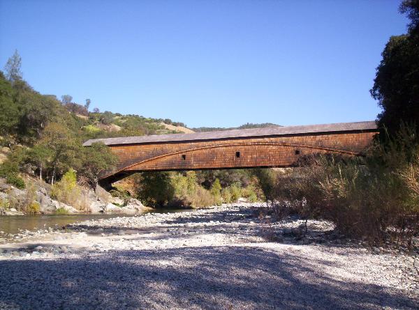
bridge is in very good condition considering its age. Built in 1862, at 251
feet, it is the longest single span covered bridge in the United States.
The type of construction is unique, a Howe truss with an auxiliary Burr arch.
The arch is visible from the outside as well as the inside, consisting of two
five by fourteen inch timbers bolted together, squeezing between them the
members of the truss. This combination, made from local Douglas Fir, and resting
on massive granite blocks, endured the weight of a 13 ton tractor without
excessive strain. Today the bridge is rated at 3 tons because of the age of the
timber. The unique design seems to have been taken from a plan or design
prepared by Theodore Burr for a bridge constructed in 1804, across the Hudson
River and patented in 1817.
The Sugar Pine shake roofing and sides not only protect the timber from the
weather, but contribute an air of historic antiquity which attracts many
visitors to see and photograph it.
In 1853, the California Legislature authorized the formation of "Turnpike
Companies" that would build roads and bridges and maintain and operate them
as business ventures. County governments were newly formed and generally without
funds to build or maintain the many roads and bridges, thus creating the need
for the "Turnpike Companies". Tolls were approved by the local county
Boards of Supervisors.
The Virginia Turnpike Company, organized in 1856, by David I. Wood, arranged for
construction of the toll road from a point near the Anthony House (under present
day Lake Wildwood), to French Corral, a distance of 10 miles. The later became a
portion of the heavily traveled route between Marysville and Virginia City.
The bridge was built under the direction of Mr. Wood. The lumber was produced
by his sawmill in Forest City. The bridge was taken over by Nevada County from
the Virginia Turnpike Company in 1901. From that date no further tolls were
charged.
The Bridgeport Covered Bridge was acquired by the State Department of Parks and
Recreation in 1986, and is now the centerpiece of the South
Yuba River State Park.
The bridge is both a State and National Historic Landmark. It is truly a living
memorial to the high degree of individual initiative and private enterprise
which was such a driving force in 19th century California.
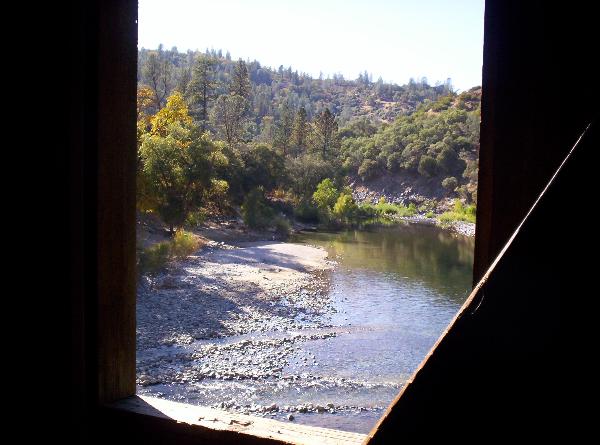
Located on and about a long stretch of the South Yuba River, the South Yuba
River State Park extends from the Englebright Reservoir below Bridgeport into
the Tahoe National Forest. Visitors can swim at a number of choice spots along
the river, pan for gold, or explore the trails which lead to historic mining
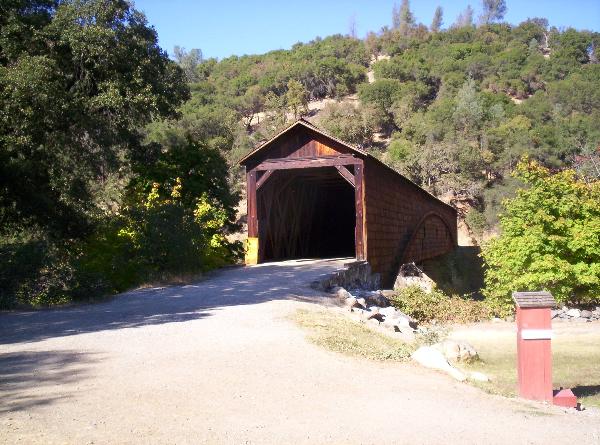
sites. The main attraction of the Park is the Bridgeport Covered Bridge.
Constructed of timber, iron bolts, and braces, this 225-foot span is the longest
covered bridge of its kind in the United States. Built by David Wood in 1862,
the bridge crosses the South Fork of the Yuba River and is one of the local's
favorite spots to cool off on a hot summer's day.California State and National Parks in or about the Gold Country
This 20-mile portion of the south fork of the Yuba
River canyon stretches from Malakoff
Diggins State Historic Park to Bridgeport. The area includes the longest
single-span covered bridge in the world, four miles of the steep rugged canyon
of the South Yuba River, and the Independence Trail — a wheelchair accessible
trail.
South Yuba River State Park offers many scenic vistas. Visitors can view fast
water pouring over massive granite ledges, and historic toll crossings and
bridges that tell a story of day-to-day life during the Gold Rush era.
Visitors can enjoy swimming, hiking, panning for gold, beautiful wildflowers, or
exploring the trails leading to such historic mining sites as the Miner's Tunnel
and Jones Bar. Docent-led history, nature, and gold-panning tours are also
offered at selected times throughout the year.
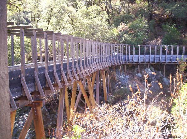
Adventuresome hikers have a choice of trails ranging in difficulty from the
South Yuba Independence Trail — the first identified wheelchair-accessible
wilderness trail in the country — to other more strenuous trails.South Yuba River SP