BM 84C238 - Fort Steele, BC
Posted by:  T0SHEA
N 49° 36.725 W 115° 38.122
11U E 598582 N 5496396
Along Highway 95, just south across the Kootenay River from Fort Steele and 12 kilometres north of Cranbrook is the Fort Steele Bridge.
Waymark Code: WMVKHC
Location: British Columbia, Canada
Date Posted: 04/29/2017
Views: 1
Fort Steele is the biggest and baddest tourist attraction in the area, well worth spending an afternoon exploring. It is a museum and heritage village with over 60 restored and reconstructed heritage buildings, as well as machinery, vehicles, tractors, a steam locomotive and railway cars, and artefacts galore.
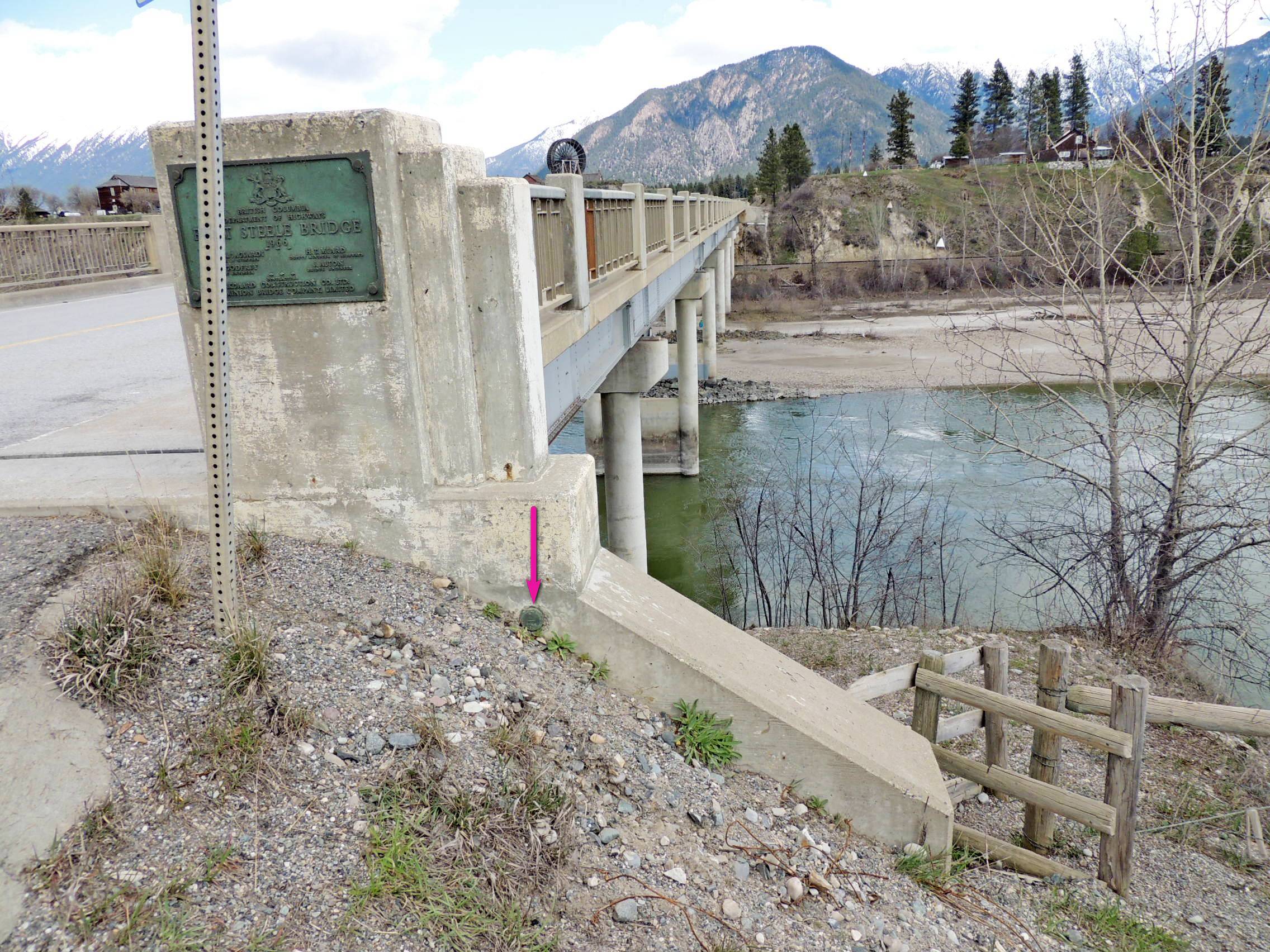
Crossing the Kootenay River just south of Fort Steele is this concrete and steel bridge, complete with benchmark. 84C238 is monumented on the southwest face of the south (southeast side of the highway) abutment wall, just above ground level. It is almost buried, but not quite.
Name		Province		NTS map sheet	Unique Number
84C238		British Columbia	082G12		84C238
Fort Steele
Bridge over kootenay river on hwy no 93-95, 1.0 km s of junc with rd to fort steele heritage park, tablet in sw face of sw conc abutment at s cor of bridge, 6.8 m se of c/l of hwy, 44 cm below sidewalk.
From NRCAN