68-C-074 - Revelstoke, BC
Posted by:  T0SHEA
N 51° 00.461 W 118° 13.105
11U E 414519 N 5651385
This is one of two benchmarks on the big Columbia River suspension bridge at Revelstoke. This one is at the north end of the bridge, the other at the south end.
Waymark Code: WMVHVG
Location: British Columbia, Canada
Date Posted: 04/22/2017
Views: 0
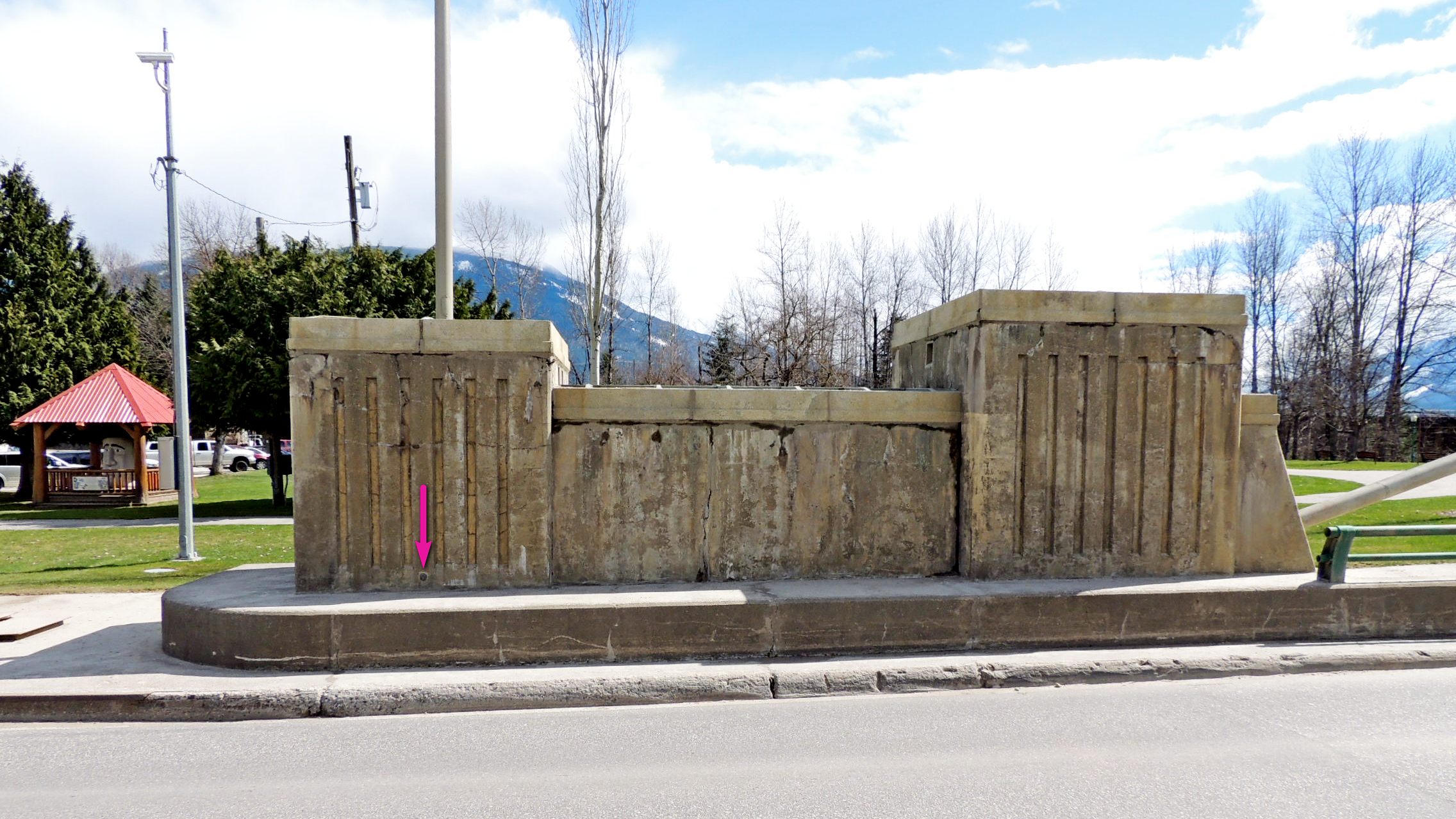
68C074 is on the southeast side of the Trans Canada Highway, in the northwest face of the end block which anchors the east side suspension cable. It is near the northeast end of the large block, six inches above a larger base which is about 1.5 feet in height.
Directly across the highway, in the matching anchor block, is the date plaque for the bridge, reminding us that the bridge came onto service in 1961.
Name		Province		NTS map sheet	Unique Number
68-C-074	British Columbia	082M01		68C074
Revelstoke
Trans canada highway bridge over columbia river, tablet in northwest face of easterly concrete end post at northeast end of bridge, 5.5 m southeast of centre line of highway, 1.2 m from southwest face of end post, 94 cm above deck level, 16 cm above concrete support slab for end post.
From NRCAN