|
 West Quoddy Head - Maine Posted by:  T0SHEA T0SHEA
N 44° 48.834 W 066° 57.126
19T E 661927 N 4964317
When standing at the given coordinates looking east, one sees the easternmost point in the US.
Waymark Code: WMV9WN
Location: Maine, United States
Date Posted: 03/20/2017
Views: 7
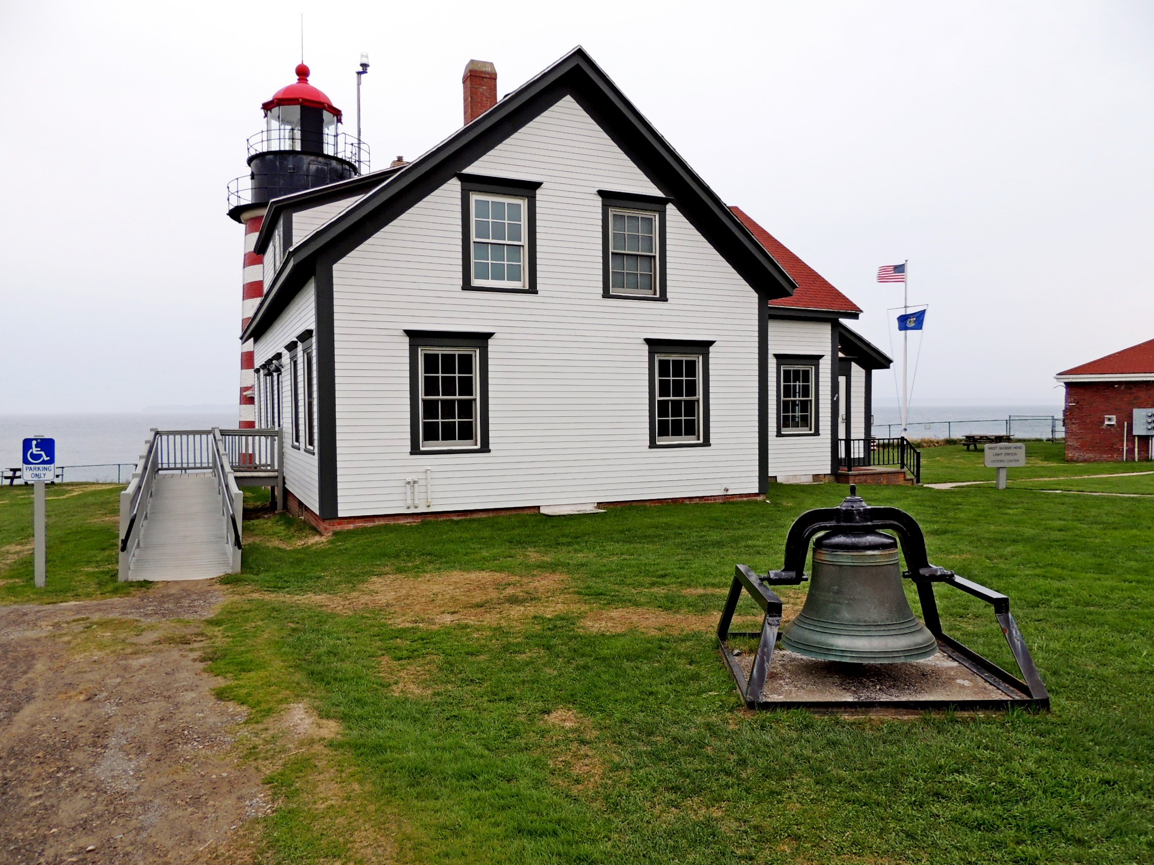
It somehow seems strange that the easternmost point in the US should be at West Quoddy Head. Regardless, that is how it came to be named. At West Quoddy Head are Quoddy Head State Park and the Quoddy Head Lighthouse, known officially as the West Quoddy Head Light Station.
The lighthouse at West Quoddy Head has the distinction of being the easternmost light in the United States, standing on the easternmost point of land in the United States. Today a National Historic Site, the station is still active, with the light still shining out to sea to warn seafarers of the dangers nearby. The rest of the site, though, has become a visitor centre, operated by the West Quoddy Head Light Keepers Association.
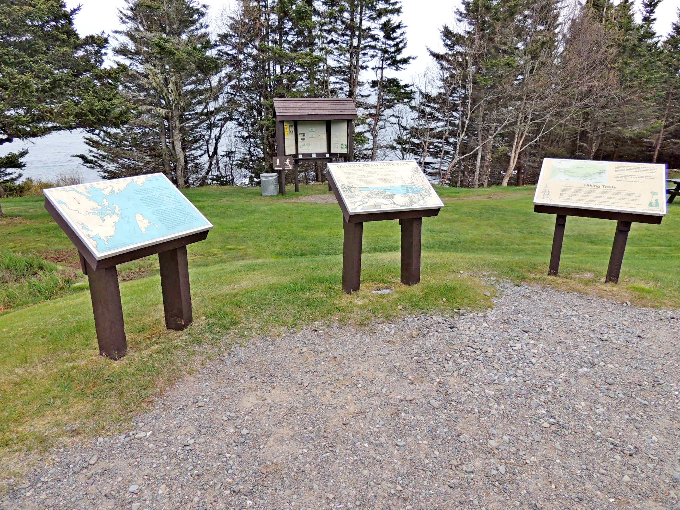
QUODDY HEAD STATE PARK
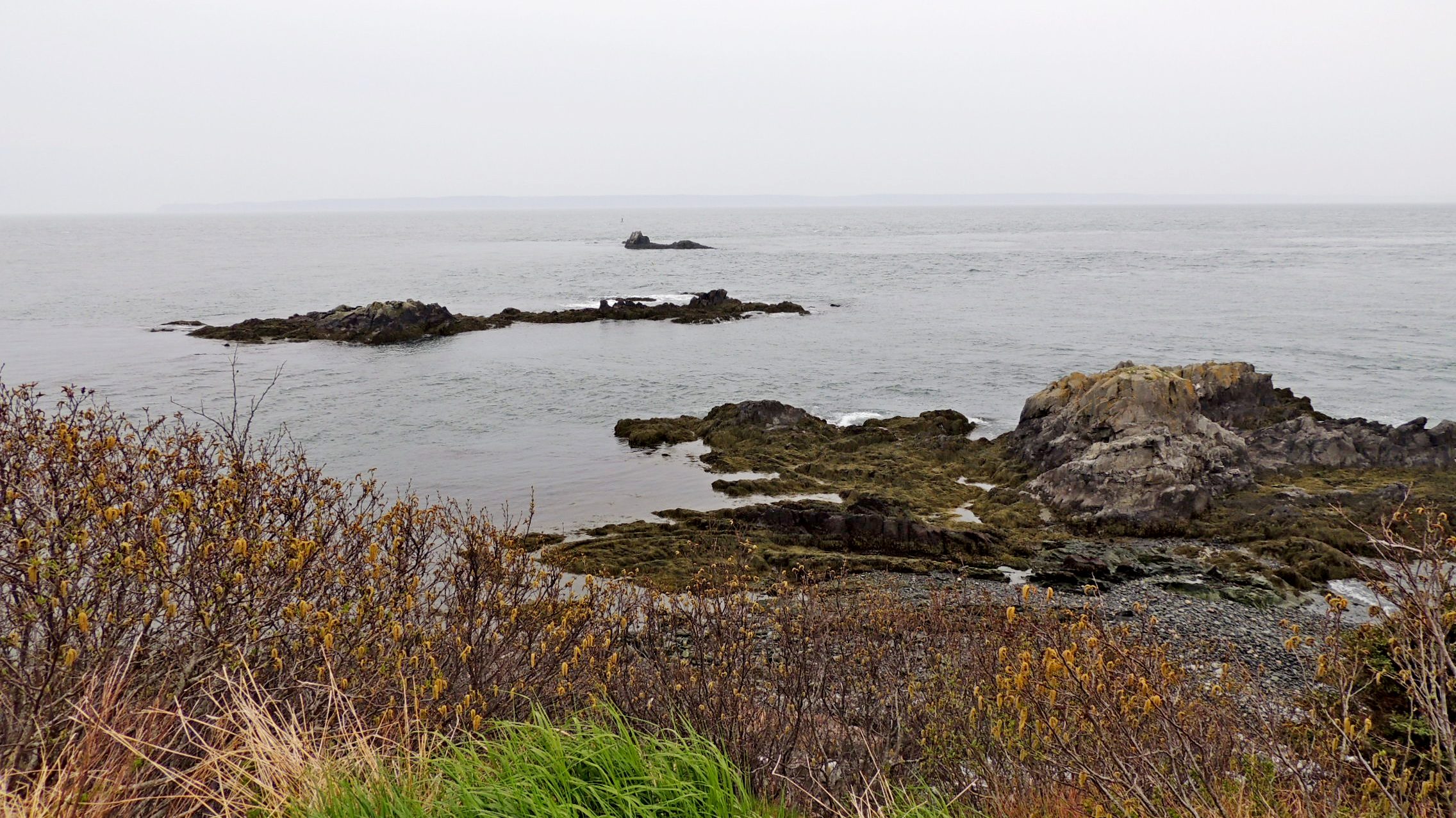
Quoddy Head State Park, located on the peninsula of West Quoddy Head, is the easternmost point in the United States. Steep rock cliffs, a peat bog and trees shaped by harsh winds characterize the park's environment. West Quoddy Head is wrapped in fog for an average of 59 days a year, and has some of Maine's coolest summer temperatures. Over time, these temperatures, a moist climate and the area's topography created conditions for the formation of a coastal peat bog — a park feature typical of maritime eastern Maine and New Brunswick.
The park's rock cliffs are remnants of marine volcanoes that erupted 420 million years ago and now form the bedrock of much of coastal Maine and New Brunswick. The horizontal volcanic layers were tilted almost to vertical along the Fundean fault — a fracture in the earth's crust that parallels the coast just off the park's shores. Glacial scouring and the battering surf have carved the cliffs, which rise 90 to 150 feet from the sea.
From a plaque in the park
The entry from the American Guide Series book Maine: A Guide 'Down East' follows.
Right on the local gravel road is West Quoddy Head (alt. 40), 8 m., the most easterly point of the United States, where a Coast Guard station and a lighthouse are maintained. From this point the high cliffs of Grand Manan Island are visible on a clear day.
From Maine: A Guide 'Down East', Page 277
 |
 |
| The Lighthouse |
Quoddy Head |
 |
 |
| The Keeper's Quarters |
Plaques in the Park |
Quoddy Head
A lighthouse beacon and fog signal have guided ships through the Quoddy Narrows between Campobello and West Quoddy Head since 1808. The present brick, red-and-white banded lighthouse was built in 1858. The beacon, 83 feet above sea level, can be seen from 20 miles at sea on a clear night. A radio beacon from the lighthouse serves as a navigational aid. A whistle or groaner buoy, located one mile offshore sounds a warning for Sail Rock.
West Quoddy Head Light looks over the islands of two nations. Campobello, The Wolves and Grand Manan lie in Canada. Sail Rock, which reportedly caused many shipwrecks off these shores, belongs to the United States.
Finback, minke, humpback and northern right whales migrate here each summer from their winter habitats off the southern coast of North America and the north-eastern coast of South America. They find these waters rich with food, such as herring, mackerel and microscopic plant and animal life. Studies show that northern right whales mate, and northern rights and finbacks calve in this part of the Bay of Fundy.
These whales can be recognized by the distinctive shapes of their dorsal fins and tails. When exhaling, whales also emit a characteristic "blow", which aids in identification.
The waters off West Quoddy Head peninsula form part of the open end of Canada's Bay of Fundy, which lies between New Brunswick and Nova Scotia.
The shape of the Bay of Fundy causes extremely high tides. At West Quoddy Head, tides rise and fall an average of 15.8 feet in six hours. The cool, nutrient-rich waters host abundant marine life in the large intertidal zone. Northern types of seaweed are found here, along with arctic clams and snails, anemones and sea stars.
Grand Manan Island, New Brunswick, lies about ten miles southeast of West Quoddy Head and, on clear days, can be seen from many points on the park's shoreline. Grand Manan is famous for spectacular rock cliffs along its west shore that rise 200 to 400 feet. The island was first settled by British Loyalists who fled the American Revolution. Today, as in the past, Grand Manan's population of about 2,300 lives on the island's east coast, where fishing for herring, cod and lobster is a way of life.
From a Plaque in the Park
Book: Maine

Page Number(s) of Excerpt: 277
Year Originally Published: 1937
|
Visit Instructions:
To log a Visit, please supply an original image of the Waymark.
|