
Dicks Creek Falls - Dahlonega, Georgia
N 34° 40.797 W 083° 56.221
17S E 230911 N 3841477
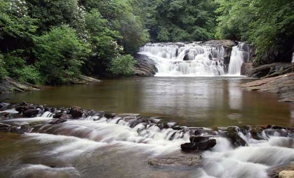
Dick's Creek Falls and the shoals above it are popular for wading and sunning in the summer
Waymark Code: WMT01Q
Location: Georgia, United States
Date Posted: 08/31/2016
Views: 5
DICK'S CREEK FALLS - DAHLONEGA, GEORGIA
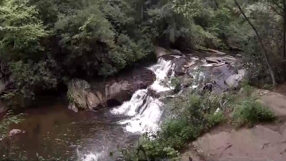
See video here:
Dick's Creek Falls
Dicks Creek Falls is located in the Chattahoochee National Forest just below the confluence of the Dicks and Waters Creek.
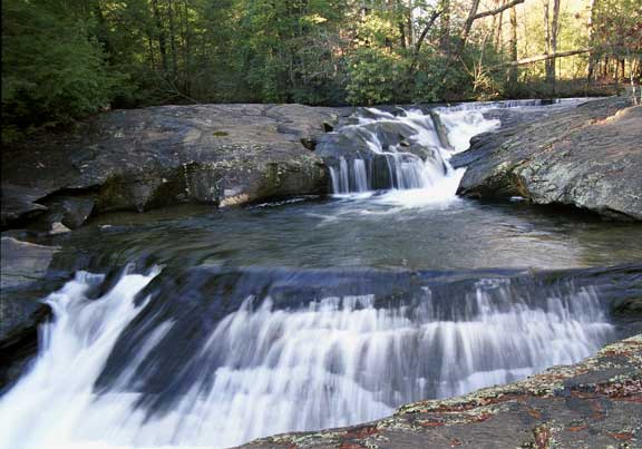
To reach the falls go north from Dahlonega 13.7 miles on US19 to Mt. Pisgah Church Road (one half mile before reaching the junction of US19 and US129 at Turner's Corner) marked by a US Forest Service sign indicating Waters Creek Campground. Turn left on this road and go 2.6 miles to the falls which will be on the left. This falls and the shoals above it are popular for wading and sunning in the summer, however care should be exercised when walking on the slippery rocks and under no circumstances should one dive into the pools.
The shoals above Dicks Creek Falls is at the confluence of Dicks and Waters Creek. Waters Creek which enters at the upper left of this photo is a a trophy trout stream.