
Survey Marker 896 - Meductic, NB
Posted by:  T0SHEA
N 46° 01.537 W 067° 32.391
19T E 613010 N 5097930
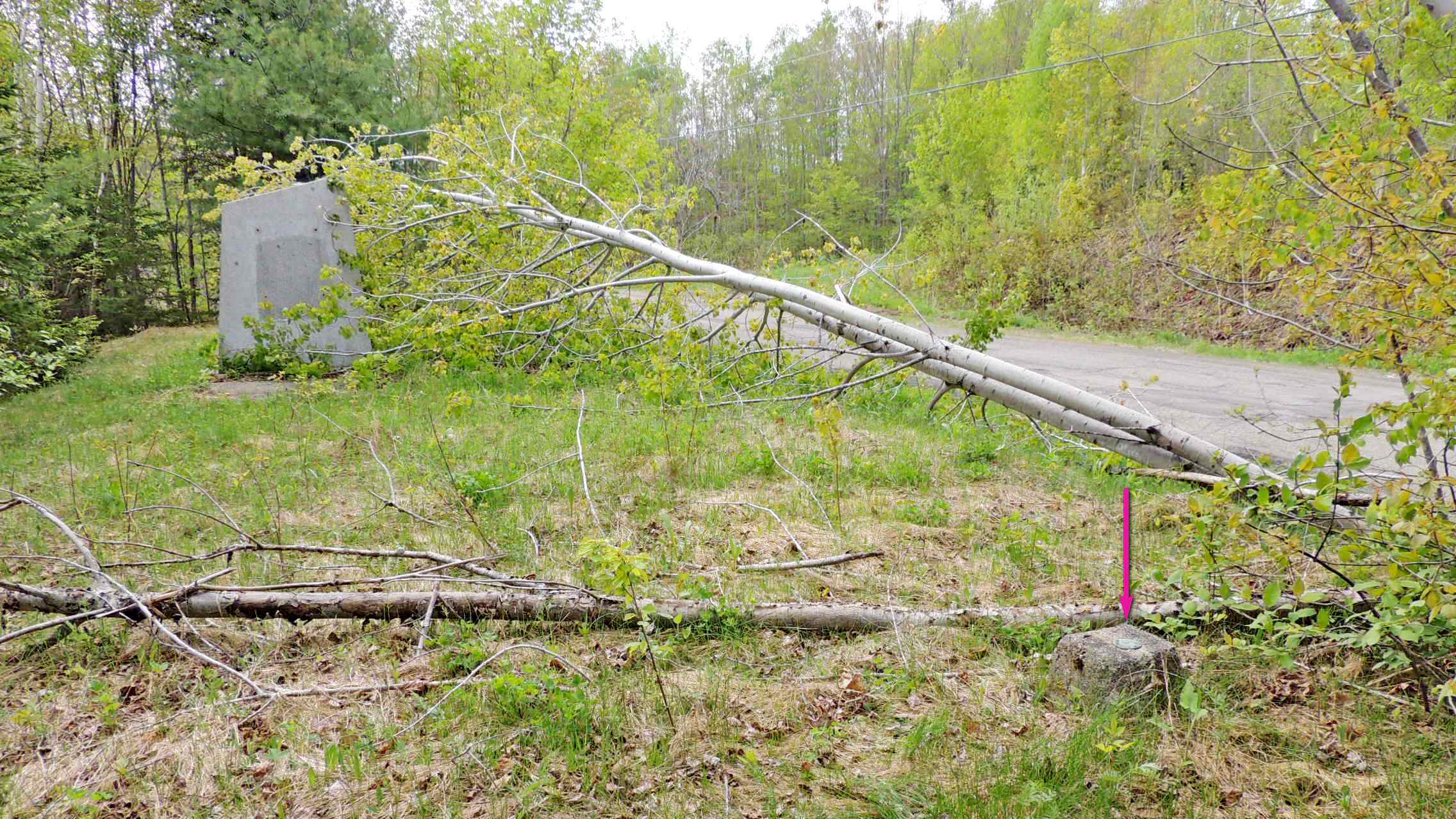
Beside the old section of Fort Meductic Road was once a CNHS plaque for Meductic Indian Village. The concrete monument remains, but the plaque has been removed. 61E896 is mounted atop a low concrete monument just north of that monument.
Waymark Code: WMRBHQ
Location: New Brunswick, Canada
Date Posted: 06/04/2016
Views: 5
Name		Province	NTS map sheet	Unique Number
N.B. 896	New Brunswick	021J04		61E896
Meductic
Concrete monument at north edge of grassy area at "Meductic Indian Village" historic site, on east side of old highway no. 2, immediately south of junction with trans canada highway, 5.1 km northwest of bridge over eel river, 175 m north of lower woodstock united church, tablet in top, 8.0 m north of historic monument, 11.0 m east of centre line of old highway. Established by New Brunswick surveys.
From NRCAN
Type of survey mark: Round brass tablet

What indicators are near the mark to help people identify where it is located?:
Tall concrete monument about 8 metres south of the marker.
What property is this mark defining?: Not listed
|
Visit Instructions:
Please submit a photo(s) taken by you of your visit to the location (non-copyrighted photos only). GPS photos are also accepted with the location in the background, and old vacation photos are accepted. If you are not able to provide a photo, then please describe your visit or give a story about the visit. If you have additional information about the survey mark which is not listed in the waymark description, please notify the waymark owner to have it added, and please post the information in your visit log.