
Moyie Dam Hydroelectric Project - Bonners Ferry, ID
Posted by:  T0SHEA
N 48° 43.631 W 116° 10.596
11U E 560553 N 5397455
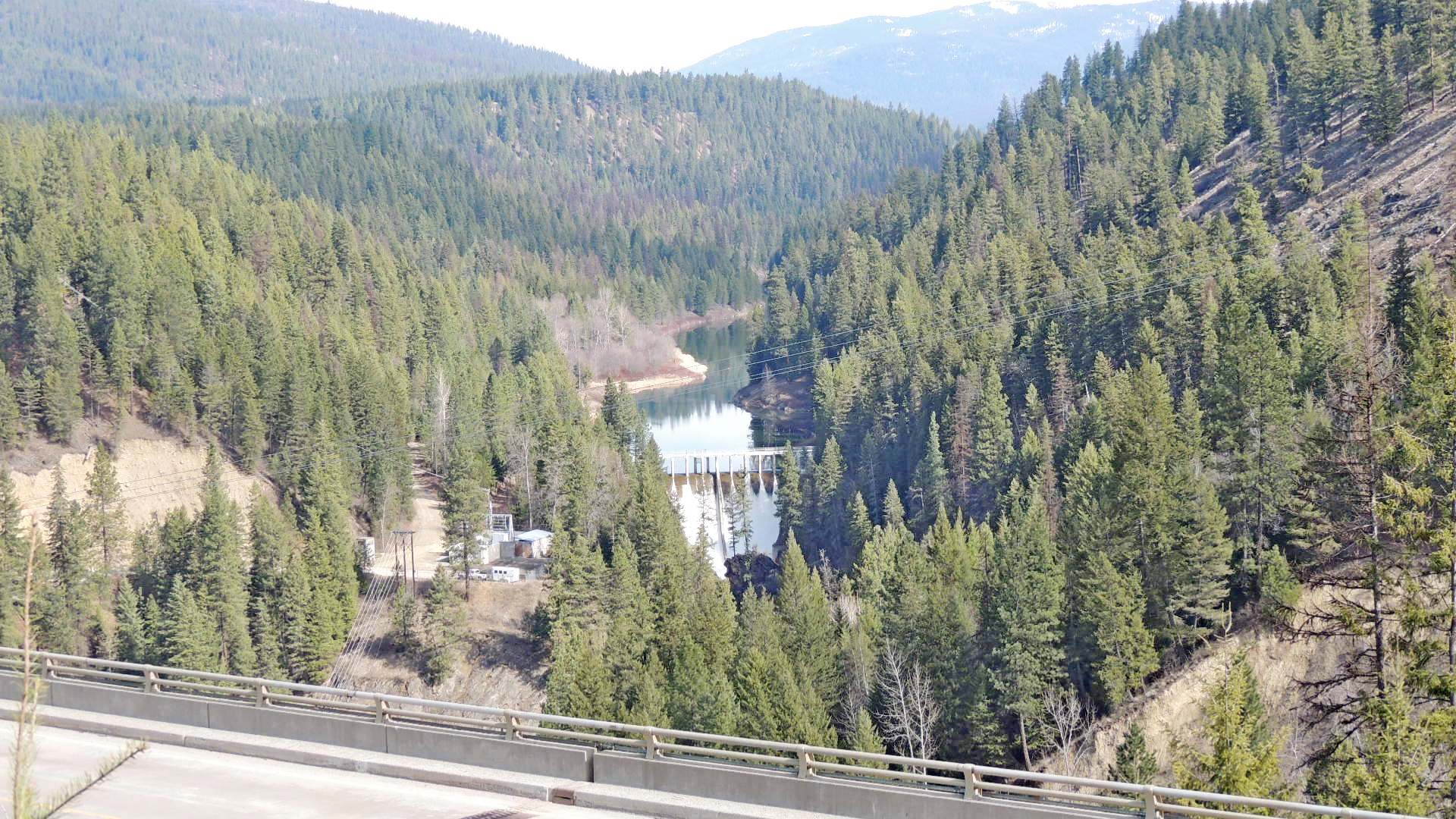
This concrete gravity dam impounds the Moyie River just 1.5 miles upstream of its confluence with the Kootenai River. It was built by and is operated by the city of Bonners Ferry, Idaho.
Waymark Code: WMQFH1
Location: Idaho, United States
Date Posted: 02/21/2016
Views: 1
Coordinates given are at a pullout and rest area on Highway 2 south of the dam, an excellent viewpoint for the dam.
As can be seen in the accompanying photos, the dam creates a nice 90 or so foot high waterfall every spring when it becomes necessary to spill water. The dam backs up a small reservoir of only about 540 acre-feet, so much of the spring melt water is lost over the top of the dam.
This is actually the second dam to have been built in the vicinity. The first, the Eileen Dam, had its left embankment washed away in a 1925 flood, leaving the dam standing with the river flowing around it. The dam itself remains in place about five miles upstream from the Moyie Dam.
This dam is 92 feet in height and 376 feet long at the top and was completed in 1949. Below it by 1,000 feet are three powerhouses which produce a total of 3950 KW, which actually creates a small profit for the city. The three power houses were built in 1921, 1941, and 1982, with one, two and one generator in each, respectively. See full details of the dam below, provided by the city of Bonners Ferry, Idaho.
Moyie Dam
The Moyie Dam is located on the Moyie River about one and one-half miles upstream of its confluence with the Kootenai River. Moyie Dam is a 92-foot-high concrete gravity dam that impounds a small reservoir, approximately one mile long. The length of the top of the Dam along the walkway at elevation 2040 is 376 feet.
Powerhouses There are three powerhouses located about 1000 feet downstream. The powerhouses were constructed in 1921, 1941, and 1982 respectively. Four hydroelectric turbines are located in the powerhouses with two units in Powerhouse Two and one unit each in Powerhouses One and Three. The nameplate capacity of the units totals 3950 KW.
Intake and Outlet Works A 60-inch diameter cast iron slide valve head gate is located behind the Moyie Dam intake trash rack at the entrance to the penstock. When needed, the head gate can be operated by a motor to close the penstock from the fore bay. The penstock system begins at the head gate with approximately 100 feet of 60-inch steel pipe followed by 650 feet of rock tunnel to a vertical shaft surge chamber. The upper portion of the surge chamber can be seen adjacent the Project GSU substation. Beyond the surge chamber, the penstock continues a short distance in 7-foot concrete pipe followed by 60-inch steel pipe into the powerhouse area. Turbine tailraces at the powerhouses return the penstock water to the Moyie River. A 72-inch diameter cast iron slide gate valve (drain valve) is located in the bottom of the dam at elevation 1968.5. If needed, this valve is opened like the head gate with an electric motor for the purpose of lowering the forebay.
Spillway The Dam has an ogee spillway with a crest 17 feet below the top of the dam. The spillway length is 95.5 feet. Piers supporting the walkway divide the spillway into nine segments. A concrete training wall on the spillway separates the spillway flow with four crest segments flowing onto the west half of the spillway and five onto the east. The spillway has the capacity of 19,800 cfs at 2037.5 feet with 2.5 feet of residual freeboard.
Source Information for the Moyie Dam is from the City of Bonners Ferry, Idaho.
From Boundary County