Lembert Dome
Posted by:  Touchstone
N 37° 52.918 W 119° 20.818
11S E 293598 N 4195315
Located within Yosemite National Park, this high point in Tuolumne Meadows offers a 360 degree view for the price of a moderate hike.
Waymark Code: WMPG
Location: California, United States
Date Posted: 08/30/2005
Views: 66
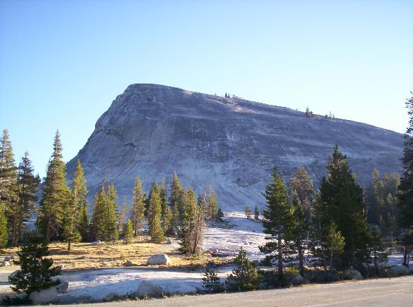
Lembert Dome is one of the most easily accessed landmarks in Tuolumne Meadows. There is a trail to the top, or if you are feeling
adventurous you can scramble up the main face of the dome. The elevation gain is a moderate 500 ft and the summit will give you views in every direction.
 How
to get there: Take Hwy 120 through Yosemite, either from Lee Vining from the
East or Crane Flats from the West.
How
to get there: Take Hwy 120 through Yosemite, either from Lee Vining from the
East or Crane Flats from the West.
The Hike To The Top: Take the turnoff for the Tuolumne Meadows High
Sierra Camp/Wilderness Backpacking Parking area. Proceed past the
Wilderness Permit office towards the High Sierra Camp. A day use lot for
Dog Lake Trailhead will be on the left a little ways down from the Wilderness
Permit office, but before the HSC. Take the trail from the parking area
North. You will eventually cross Hwy 120 and climb a gentle hill with
Lembert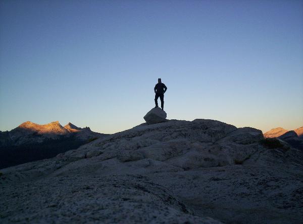 Dome visible on your left through the trees. In about a mile you'll
intersect the trail to the top of Lembert Dome heading off left through the
trees. Follow this trail for about half a mile to the saddle behind
Lembert Dome. Easy scrambling up the back of the dome will get you to the
obvious high point of the dome.
Dome visible on your left through the trees. In about a mile you'll
intersect the trail to the top of Lembert Dome heading off left through the
trees. Follow this trail for about half a mile to the saddle behind
Lembert Dome. Easy scrambling up the back of the dome will get you to the
obvious high point of the dome.
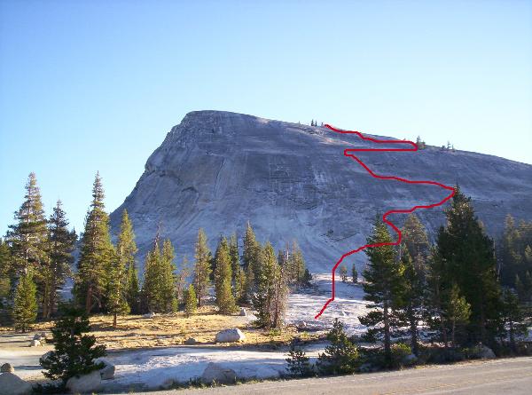
The Adventure Scramble Up The Main Face: Caution:
If you have a fear of heights, or have any doubts about your route finding
abilities, then this is not the way for you to go. The photo below
can give you a general idea on the route up the main face. The first part
of the route is basically the descent route for the rock climbing routes on the
left side of the face. Start in the picnic area at the base of the slabs
and tend towards a route that will take you to a group of small trees towards
the right. From the trees you'll see two more small trees, perhaps a
hundred feet apart, back towards the left. The rock is pretty well cleaned
off from all the traffic, but all the same, it seems like a few hearty souls end
up getting rescued each year at this point (usually by descending
climbers). After those initial difficulties there are numerous routes to
the top, but the easiest is back towards the right towards a group of large
trees, and then an angling route back left towards the summit ridge. Just keep
in mind: Don't go up, what you don't think you can get
back down.