|
 Miners Park - Sparwood, BC Posted by:  T0SHEA T0SHEA
N 49° 43.090 W 114° 50.447
11U E 655641 N 5509534
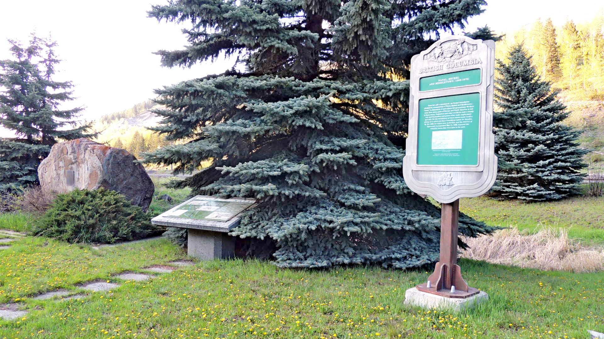
Immediately south of Sparwood on the Crowsnest Highway is a roadside pullout opposite the large Teck equipment storage yard. At the pullout is a small park which showcases a pair of Heritage markers.
Waymark Code: WMPEBW
Location: British Columbia, Canada
Date Posted: 08/17/2015
Views: 2
The heritage markers have been placed in this small park, named Miners Park in honour of the miners who worked the coal mines in the years from 1899 to 1983. In the park are also a memorial plaque mounted on a large boulder, a picnic table and a bear proof garbage container. It is a nice place for a break before heading into the Crowsnest Pass if headed toward Alberta or before entering Sparwood, if coming from Alberta.
One of the markers is a standard BC Highway Tourism sign, while the other, now partially covered by a large blue spruce, was placed by the District of Sparwood. Both deal with the history of the now extinct coal mining towns of Michel, Natal and Middleton.
The BC Heritage Marker, which tells of the towns of Natal, Michel and Middletown, reads as follows:
NATAL, MICHEL
AND MIDDLETON (1898-1976)
Gone but still remembered—no formal boundaries divided the communities of Natal, Michel and Middletown—"home" to thousands of coal miners for generations. Workers came from many parts of Europe and North America to toil in these mines. Explosions and other accidents took a steady toll, and fluctuating coal prices often made employment sporadic. Yet the inhabitants of these towns could recall a strong civic spirit and their friendships lasted for decades. By the 1960s the mines were in decline, and the District of Sparwood, incorporated May 12, 1966, replaced the colourful towns that were here in the past.
The second Heritage Marker, which tells of the towns of Michel and Natal, reads as follows:
Michel - Natal
Michel was founded in 1897, named after the famous Chief Michel of the Kootenay Indians. After the CPR opened the area with its southern line, hardy miners and their families settled the valley, the men and boys working the abundant coal fields.
By 1907, settlement had spread up the valley and the village of Natal (known initially as New Michel) was established. Named after Natal, South Africa, the name was highly unpopular at first but survived the objections of the day.
Over time, Michel and Natal were joined by other neighborhood communities — Middletown, Little Chicago, "up the Valley" (the Elk Valley) and later, Sparwood.
The history of Michel and Natal is replete with tragedy. Tragedy struck the valley in mine disasters in 1904 1916 1938 and 1967; fire destroyed much of Michel in 1902, and periodic floods, severe winters and accidents tested the character of local residents. But their history is also one of community, warmth and neighbourliness. Residents were not just neighbours but, in an emotional sense, family.
In the end it was the provincial government's desire to beautify the southeastern entrance to British Columbia which doomed Michel and Natal. An urban renewal project for that purpose begun in the late 1960s moved most residents to Sparwood and the old communities were bulldozed and burned.
Michel and Natal are now memories, but the spirit and story of their people lives on undimmed and undiminished by time.
District of Sparwood
Name: Miners Park

Street Location: Highway 3 Sough of Sparwood
Local Municipality: District of Sparwood
State/Province, etc.: British Columbia
Country: Canada
Memorial/Commemoration: Coal Miners of the area from 1899 to 1983
Date Established: July 15, 1983
Picnic Facilities: Table
Recreational Facilities:
None
Web Site: Not listed
Monuments/Statues: Not listed
Art (murals/sculpture, etc.): Not listed
Fountains: Not listed
Ponds/Lakes/Streams/Rivers/Beach: Not listed
Special Events: Not listed
Traditional Geocaches: Not listed
|
Visit Instructions:
One photo of the park that is a different view from the one on the page, and give the date and description your visit.
Add any additional information that you may have about this park. A GPSr photo is NOT required.
Recent Visits/Logs:
| There are no logs for this waymark yet. |
|
|
|
|