
Kildare Capes South Arches - Kildare Capes, PEI
Posted by:  T0SHEA
N 46° 53.208 W 063° 58.459
20T E 425770 N 5193045
There are other, larger and better known arches at Kildare Capes, but these are a well kept secret, seemingly known only to some of the more adventurous locals.
Waymark Code: WMP69N
Location: Prince Edward Island, Canada
Date Posted: 07/08/2015
Views: 7
Here's how our story began:
While touring PEI we had stopped for breakfast at the locals' favorite breakfast spot in Alberton and struck up a conversation with a table full of locals. After a few minutes one asked if we had yet sampled the local lobster. On our negative reply she told us where and how to buy some live lobster. She then informed us that we were to come to her place that afternoon at around 3 PM and she would cook them for us so we could gorge ourselves on lobster on her patio.
It turned out that they had received some (like 75 pounds) of fresh snow crab from a friend and the whole family were, that afternoon, cooking and canning snow crab. [WOW - is fresh snow crab ever sweet, it is sensational!!!] We dutifully downed all the lobster we could eat (MAGNIFICENT) and upon hearing that we were interested in old churches and cemeteries, they directed us to one that was nearby, mentioning that we should take the path from the cemetery to the beach, as there were some nice rock formations there.
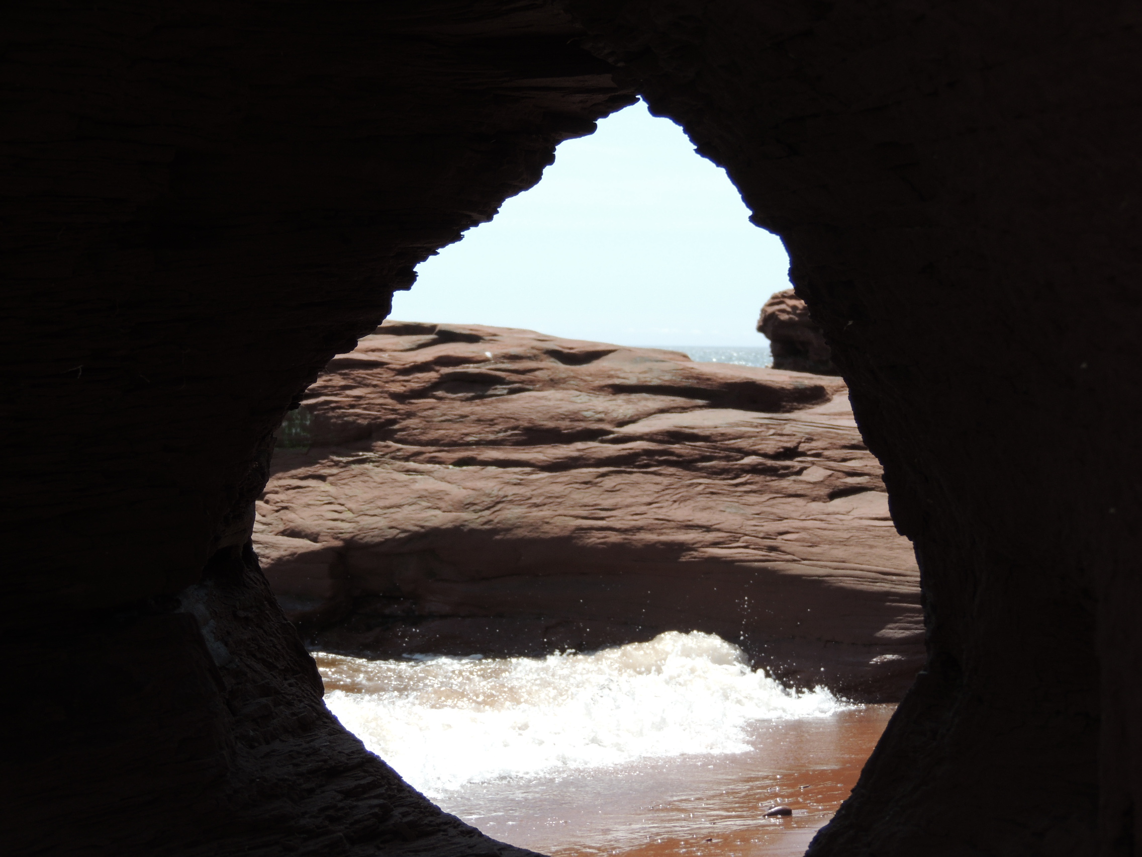
Those rock formations turned out to be these arches - a small one barely large enough to crawl through and a much larger one. The shore along much of the coast in the area consists of red sandstone cliffs of varying heights. The sandstone, being relatively soft, has been carved into a myriad of shapes, including voids in the rock.
The larger arch is actually a pillar carved out by the water, supporting the rock and earth above. The highest tides cover the base of the pillar while bigger waves during high winds continue to enlarge the opening and diminish the pillar.
The church mentioned above is Christ Anglican Church, begun in 1850, along Highway 12 about one kilometre south of Kildare Capes. The Church itself has an interesting story (to be posted soon). The path is a reasonably distinct one leading east toward the beach and these arches.
At the rear of the cemetery from which the path leads there is a memorial stone placed to commemorate 160 fishermen who died in the gale of 1851. A few metres in front of the memorial is the grave of someone who died at the age of 82. Who was that?
Visit Instructions:Visitors must answer the verification questions (or post a photo when that alternative is allowed). The answers should be emailed to the waymark owner for verification, not to the category officers. Answers should never be posted in the logs. Visitor are also asked to rank their experience for "Wow". Premium members should use the ranking feature (1 means "wasn't worth the visit" and 5 means "Wow"). Non-premium members can let us know in their logs.