
Standing Descent - Ohiopyle, Pennsylvania
N 39° 52.049 W 079° 29.674
17S E 628754 N 4414134
This Sign is one of several waysides located at the Park Office and Visitor Center of Ohiopyle State Park, which is located within the Falls Day-Use Area, the focal point of the park.
Waymark Code: WMNRJV
Location: Pennsylvania, United States
Date Posted: 04/25/2015
Views: 3
Standing Descent
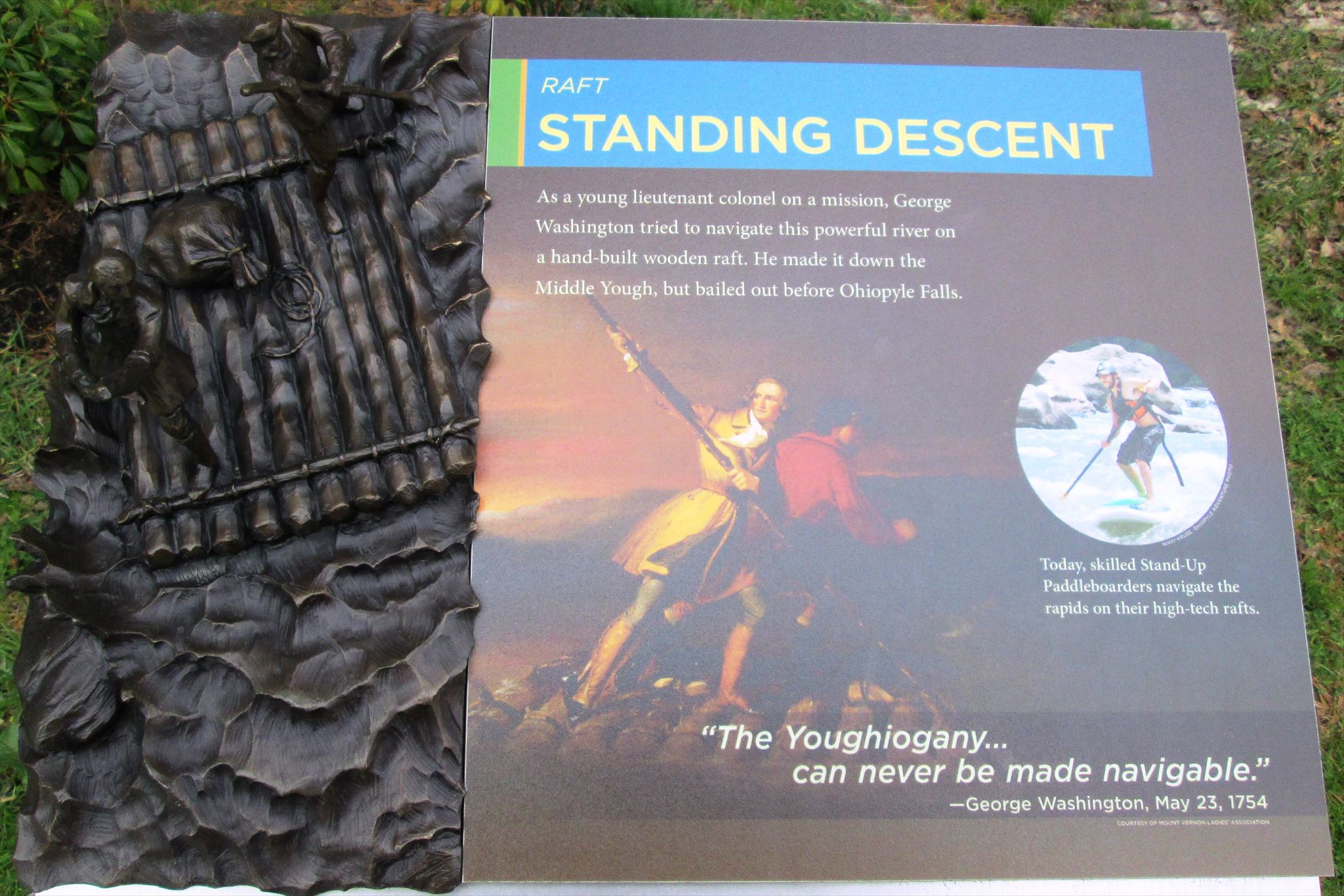
This wayside is one of five in a series at the new Park Office/Visitor Center of Ohiopyle State Park. This series focuses on the river navigation of the Youghiogheny River, the focal point of the park.
Standing Descent
As a young lieutenant colonel on a mission, George Washington tried to navigate this powerful river on a hand-built wooden raft. He made it down the Middle Yough, but bailed out before Ohiopyle Falls.
[Illustration of Washington]
[circle of Paddleboarder]
Today, skilled Stand-Up Paddleboarders navigate the rapids on their high-tech rafts.<br<
"The Youghiogany...can never be made navigable."
-George Washington, May 23, 1754
Courtesy of Mount Vernon Ladies Association
Group that erected the marker: Mount Vernon Ladies Association

Address of where the marker is located. Approximate if necessary:
124 Main Street
Ohiopyle, PA USA
15470
URL of a web site with more information about the history mentioned on the sign: Not listed
|
Visit Instructions:
Take a picture of the marker, preferably including yourself or your GPSr in the photo. A very detailed description of your visit may be substituted for a photo. In any case please provide a description of your visit. A description of only "Visited" or "Saw it while on vacation" by anyone other than the person creating the waymark may be deleted by the waymark owner or the category officers.