
Moyie River Canyon - Boundary County, ID
Posted by:  T0SHEA
N 48° 43.631 W 116° 10.596
11U E 560553 N 5397455
This is a second sign at a pullout at the east end of the Moyie Canyon Bridge, telling travelers of the Moyie River Canyon and the bridges which have crossed it.
Waymark Code: WMN9Y7
Location: Idaho, United States
Date Posted: 01/28/2015
Views: 1
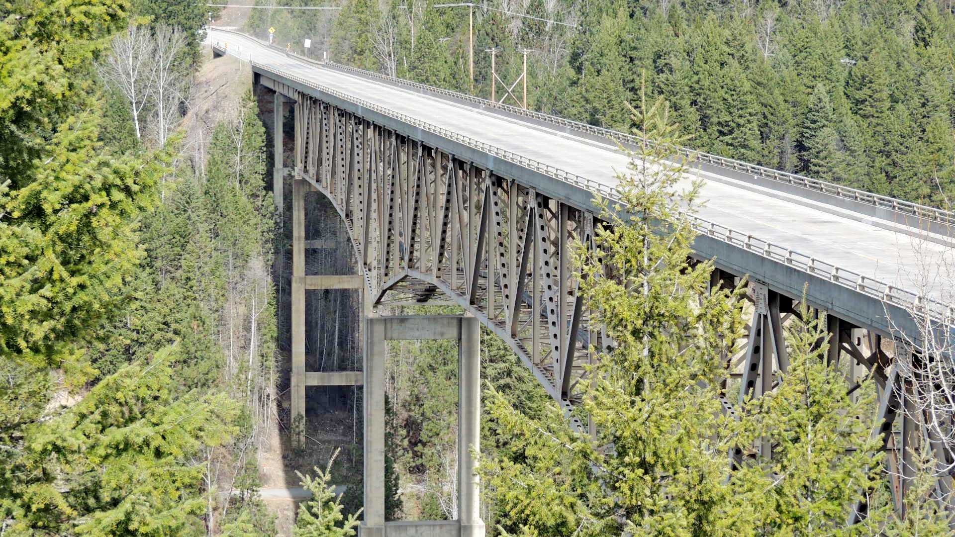
Spanning the Moyie River Canyon and the Moyie River below, the steepness and depth of the canyon necessitated a rather large bridge. Such wasn't the case 92 years ago in 1923 when the first bridge on this spot was built. It was built across the bottom of the canyon and required an extra 1¼ miles of twisting and turning narrow highway down into the canyon and back up the other side.
This is a cantilever truss bridge standing on tall reinforced concrete piers in the canyon and has steel girder approach spans on each end.
The pullout on the east end of the bridge affords a great view of not only the bridge but the Moyie River Dam north up the river from the highway.
Transcribed from sign
Group that erected the marker: Idaho Department of Highways

Address of where the marker is located. Approximate if necessary:
Highway 2
1/4 mile west of
Moyie Springs, ID USA
83845
URL of a web site with more information about the history mentioned on the sign: Not listed
|
Visit Instructions:
Take a picture of the marker, preferably including yourself or your GPSr in the photo. A very detailed description of your visit may be substituted for a photo. In any case please provide a description of your visit. A description of only "Visited" or "Saw it while on vacation" by anyone other than the person creating the waymark may be deleted by the waymark owner or the category officers.
Recent Visits/Logs:
| There are no logs for this waymark yet. |
|
|
|