|
 University Area Historic District - Missoula, MT Posted by:  T0SHEA T0SHEA
N 46° 51.605 W 113° 59.601
12T E 271842 N 5193966
The University Area Historic District encompasses an area of 50 blocks immediately west of the university, housing many university students and faculty, as well as several sororities and fraternities.
Waymark Code: WMN5ME
Location: Montana, United States
Date Posted: 12/30/2014
Views: 1
Bounded by south 4th East Street on the north, Beckwith Avenue on the south, Arthur Avenue on the east and Higgins Avenue on the west, this is an old neighborhood which grew with the adjacent university. The university opened in 1899 and by that time there was already a sizeable community in the University Area Historic District. It contains many of the finer homes in Missoula. Essentially residential, the only commercial elements are along the east side of Higgins Avenue and to a smaller degree along the west side of Arthur on the eastern boundary of the district, adjacent to the campus.
Coordinates given are in the centre of the district, on University Avenue, directly west of the centre of The Oval, the centre of the campus.
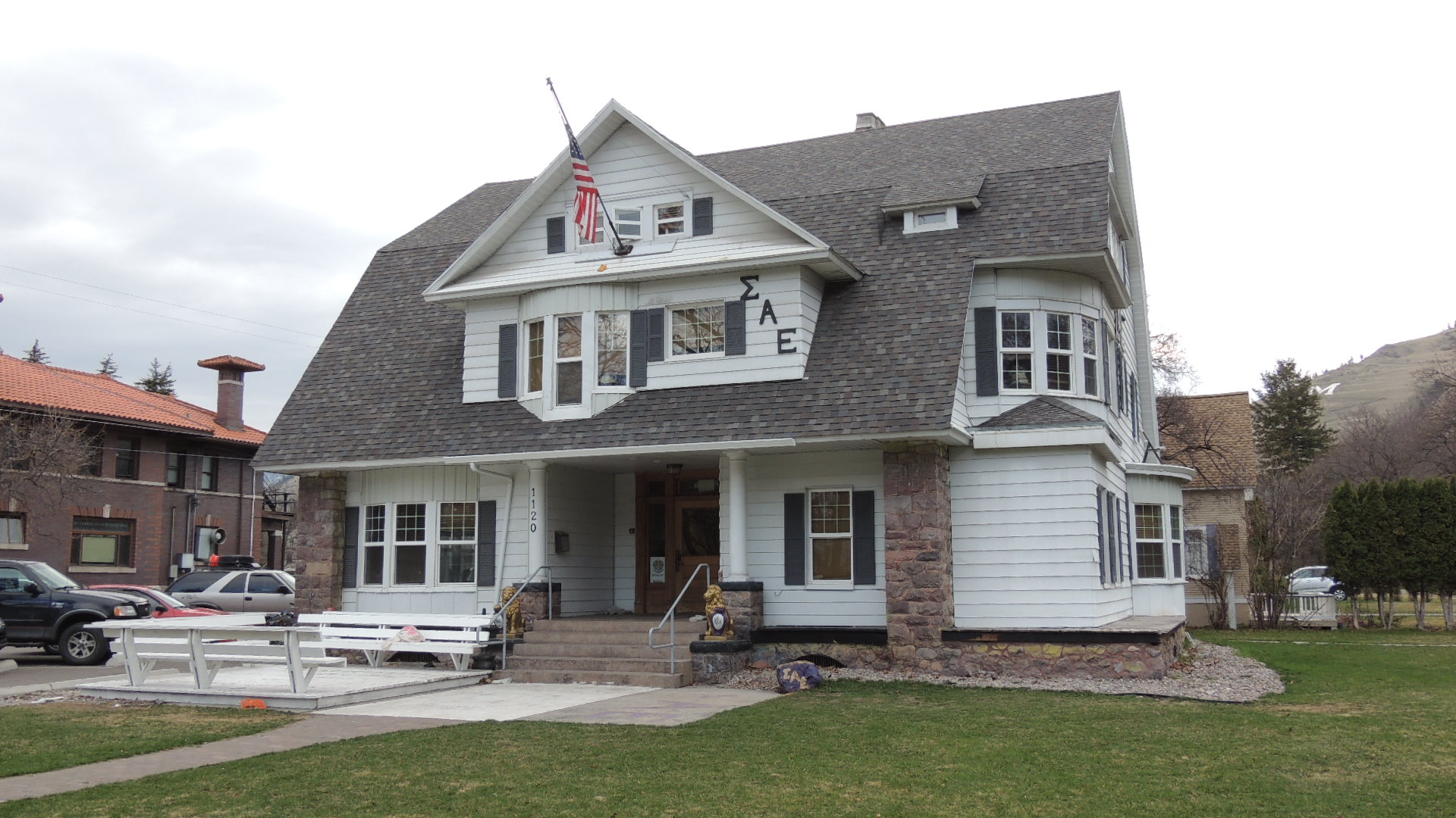 Sigma Alpha Epsilon Fraternity
University Area Historic District
The University Area Historic District is made up of 43 full and 7 partial, predominantly residential blocks, that lie within the platted areas of the Montana Addition and Hammond Additions Number 1 and 2, and part of Hammond Addition Number 3. A thin commercial element exists along the east side of Higgins Avenue and to a lesser extent along the west side of Arthur on the eastern boundary of the district. Fraternities, sororities, and churches are interspersed throughout the district. The district begins just to the south end of the Higgins Avenue Bridge (South 4th Street East), connecting the west side of the district to a thriving downtown business community. The Van Buren Bridge connects the district's eastern edge 10 the business community. The University District is roughly bounded by South 4th East to the north, the alley between Beckwith Avenue and Evans to the south, Arthur Avenue and the university campus to the east, and the business thoroughfare of Higgins Avenue to the west.
The district contains 451 main buildings, of which 355 are contributing, including 10 primary. Most of the buildings are single-family residences. There are 334 outbuildings (including garages, sheds and garage/apartments). All but 78 of the outbuildings are
contributing. The district also contains 17 purely commercial buildings, primarily along Higgins Avenue, 5 churches, 7 church-related buildings, and 1 school. Fraternities and sororities occupy 11 of the main structures. There are approximately 82 clearly identifiable buildings serving as apartment units. However, many apartments are contained within buildings that outwardly look like single-family dwellings. Residential lot sizes vary depending on the neighborhood, but typically measure 30 x 130 feet or 30 x 155 feet. A
majority of the residences sit on two or more lots. The historic period of the district is from 1887-1940. Development began in the
early 1890s and most of the homes standing today were constructed by 1920. Those areas that developed rapidly after 1920 were mostly near the east and south sides of the district. Neighborhoods throughout th!e district were almost fully developed by WWII. A small number of homes in the area were built in the late 1940s and early 1950s, and some in the 1960s.
The residential feeling of the district is enhanced by mature boulevard trees, mainly of the maple variety, and common setbacks for
the residences. The intense traffic flow generated along both east and west boundary streets (Arthur and Higgins) tends to mark an
end to the residential neighborhood character in favor of more commercial development. Beckwith Avenue on the south, also has the
feel of a major transportation artery, as do 5th and 6th Streets East.
From the NRHP Registration Form
Street address:
University Avenue
Missoula, MT USA
59801

County / Borough / Parish: Missoula County
Year listed: 2000
Historic (Areas of) Significance: Exploration/Settlement, Social History, Architecture, Community Planning And Development
Periods of significance: 1925-1949, 1900-1924, 1875-1899
Historic function: Commerce/Trade, Domestic, Religion
Current function: Commerce/Trade, Domestic, Religion
Privately owned?: yes
Season start / Season finish: From: 01/01/2014 To: 12/31/2014
Hours of operation: From: 12:00 AM To: 12:00 AM
Primary Web Site: [Web Link]
Secondary Website 1: [Web Link]
Secondary Website 2: Not listed
National Historic Landmark Link: Not listed
|
Visit Instructions:
Please give the date and brief account of your visit. Include any additional observations or information that you may have, particularly about the current condition of the site. Additional photos are highly encouraged, but not mandatory.
Recent Visits/Logs:
| There are no logs for this waymark yet. |
|
|
|
|