|
 LARGEST - Lake West of the Mississippi Posted by:  T0SHEA T0SHEA
N 48° 01.406 W 114° 13.526
11U E 706868 N 5322629
If we assume Red Lake in Minnesota and Lake of the Woods to be north of the Mississippi River as opposed to west of it, Flathead Lake would be the largest natural lake in the U.S. west of the Mississippi.
Waymark Code: WMN57H
Location: Montana, United States
Date Posted: 12/28/2014
Views: 2
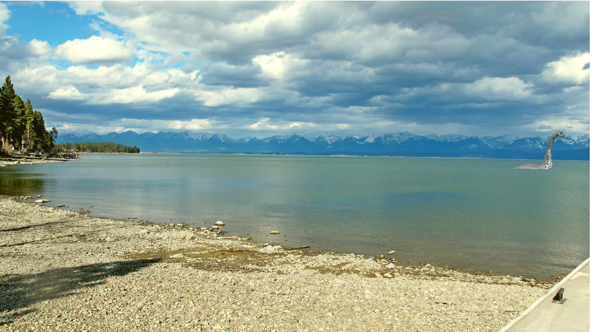
FLATHEAD LAKE, about 30 miles long and 10 miles wide, has an average depth of 220 feet. A product of glacial action, it is fed
mostly by the icy waters of melting glaciers and snowbanks in the high mountains to the east and north. Its outlet during the glacial age was westward through the Big Draw at Elmo into Little Bitterroot River; as the ice receded, a new outlet, from Poison Bay into Flathead River, developed. Local lore has it that Paul Bunyan became interested in Polson (see below), and in an effort to boom that town dug the new channel that replaced the Big Draw.
Flathead Lake offers opportunities for boating, swimming, and fishing. (Fishing best in June.) It is stocked with salmon, trout, whitefish, and bass. Several charming islands lie near the west shore. Near Dayton, accessible only by boat, are the PAINTED ROCKS, signs and characters in vivid colors left by an unknown Indian artist or historian long before white men saw the region.
For several years, land-locked sockeye salmon have been increasing in Flathead Lake. Large land-locked salmon are taken from Flathead Lake by trolling or snagging in late September and October. In the milder valleys west of the Continental Divide certain fruits do well. Sweet cherries have been grown in the Flathead Lake region for many years.
Montana: A State Guide Book, 1939
Much has changed along the shores of Flathead Lake since 1939, primarily in the way of development, both residential and recreational. There are several municipal and state parks on the lake, most being on the west side of the lake along Highway 33.
The lake remains a very popular fishing and recreational spot. It is renowned for being one of the cleanest lakes anywhere within a populated area. There are now several towns and communities around the lake, with Polson, the seat of Lake County, on the lake's south end being the largest.
With a surface area of 191.5 square miles and a maximum depth of 370.7 feet, Flathead Lake lies in both Flathead and Lake counties in northwest Montana. Formed by glacial deposits, the lake has an average depth of 164.7 feet (50.2 m), which is greater than the average depths of both the Yellow Sea and the Persian Gulf. In area it is slightly larger than Lake Tahoe. The depth of the lake is regulated by the Kerr Dam on the Flathead River, which drains the lake. Kerr Dam is about four miles downriver from the lake.
Flathead Lake (Salish: clq?etk?) is the largest natural freshwater lake west of the Mississippi River in the contiguous United States, taking Red Lake (Minnesota) and Lake of the Woods to be north of the Mississippi River, rather than west of the river. With a surface area of between 191.5 sq mi (496 km2) and 197 sq mi (510 km2), Flathead Lake is slightly larger than Lake Tahoe.
From Wiki
Type of documentation of superlative status: Wikipedia and website below

Location of coordinates: Lakeside Marina at northwest corner of lake
Web Site: [Web Link]
|
Visit Instructions:
Post one photo of the waymark that is a different view from the one on the page and describe your visit, including the date. Other information that you may regarding the waymark is encouraged. Neither you nor your GPSr need to appear in any photos!
Recent Visits/Logs:
| There are no logs for this waymark yet. |
|
|
|
|