|
 Whitefish Lake - Flathead County, MT Posted by:  T0SHEA T0SHEA
N 48° 25.017 W 114° 21.084
11U E 695968 N 5366033
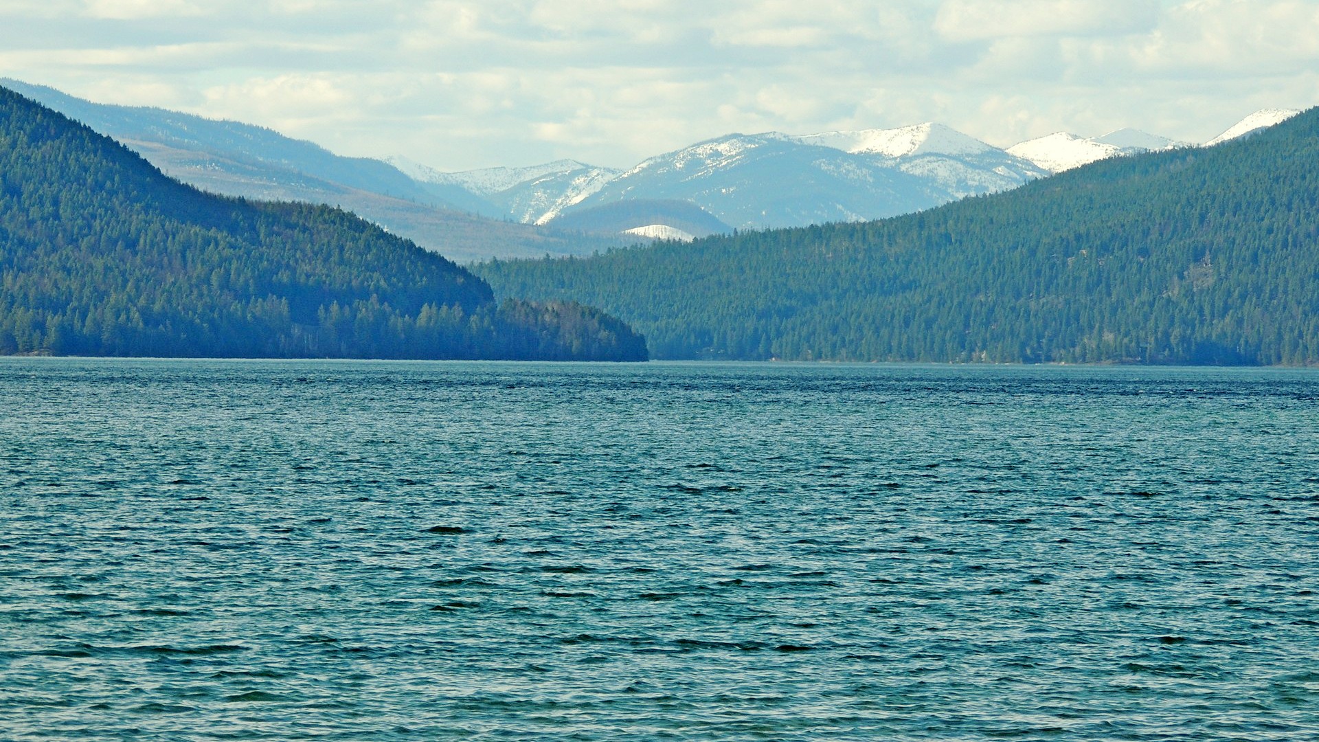
Whitefish Lake is the second largest natural lake fully inside Flathead County, Montana. Only Lake McDonald, to the northeast, is larger.
Waymark Code: WMN4ZP
Location: Montana, United States
Date Posted: 12/27/2014
Views: 2
WHITEFISH LAKE, 1 mile wide and 7 miles long, stretches north-
ward with many summer homes and camps along its forested shores.
Between the town and the lake is a public park and bathing beach. A
regatta (July 4th) features outboard motorboat racing, aquaplaning,
swimming, and diving.
Montana: A State Guide Book, 1939
Still a popular lake for recreation, the best access is from the city of Whitefish or at Whitefish Lake State Park, on the southwestern corner of the lake, just outside the city of Whitefish.
Had we not experienced the latest ice age 12,000 years ago, we would not have a Whitefish Lake. It was formed with the deposition of glacial till in the valley which impounded the waters of the lake when the ice melted 10,000 years ago.
Seven miles in length, Whitefish has a shoreline of 15.85 miles and an area of 3,341 acres. Its average depth is 109 feet, with a maximum depth of 232 feet. It has a mean volume of 480,798,030 cubic metres and is drained by the Whitefish River, which flows from its southern end. It is fed by several smaller creeks around its perimeter.
Below is the text from a historical marker on the beach at the southern end of the lake, at which coordinates were taken. With settlement around the lake it has become a much used recreational lake for swimmers, boaters and fishermen.
Welcome to Whitefish Lake
Whitefish Lake Geologic History
If you were standing here 12,000 years ago, you would have been buried below an advancing glacier nearly 3,000 feet deep. Originating in Canada, this "Stillwater Glacier" flowed south-southeast into the Flathead Valley.
As the glacier moved forward, it deposited huge piles of sand, gravel, cobbles and boulders known as glacial till. As temperatures increased in the late ice age, the ice melted but continued moving forward at the same rate, which created the dam—or glacial moraine that impounds Whitefish Lake today.
When the area became ice free around 10,000 years ago, it revealed Whitefish Lake and the surrounding landscape. Since its formation, Whitefish Lake has been a cold, clear lake with very good water quality. European settlement around the lake began approximately 125 years ago, representing about 1% of the lake's geologic history. Ongoing recreation and development continues to place pressure on the lake and may compromise water quality.
From the marker
Book: Montana

Page Number(s) of Excerpt: 295
Year Originally Published: 1939
|
Visit Instructions:
To log a Visit, please supply an original image of the Waymark.
|