
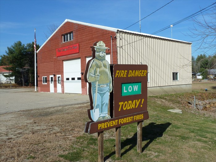
West Ossipee Fire Dept. Central Station Smokey - West Ossipee, NH
Posted by:  silverquill
N 43° 49.351 W 071° 12.278
19T E 322717 N 4854522
This Smokey Bear sign is located on the south side of the Central Fire Sation along Route 16 in West Ossipee, New Hampshire.
Waymark Code: WMN232
Location: New Hampshire, United States
Date Posted: 12/10/2014
Views: 2
From the web site for the West Ossipee Fire Precinct:
The West Ossipee Fire Precinct provides fire protection and emergency medical services to the residents of West Ossipee, New Hampshire. West Ossipee is a village within the Town of Ossipee in Carroll County. The West Ossipee Fire Precinct is one of the three fire precincts within the Town of Ossipee. The fire precinct is a member of the Ossipee Valley Mutual Aid Association.
The West Ossipee Fire Precinct operates out of two locations. The Central Fire Station is located at 2380 Route 16 and the Jewell Hill Station is located at 11 Jewell Hill Road. The administrative and fire department offices are located in the Central Fire Station.