
Blackwell Flats Rec Area Ramp - Libby, MT
Posted by:  T0SHEA
N 48° 22.189 W 115° 19.252
11U E 624355 N 5358767
This is one of a bunch of boat ramps available along the Kootenai River east of Libby.
Waymark Code: WMN0Y0
Location: Montana, United States
Date Posted: 12/04/2014
Views: 1
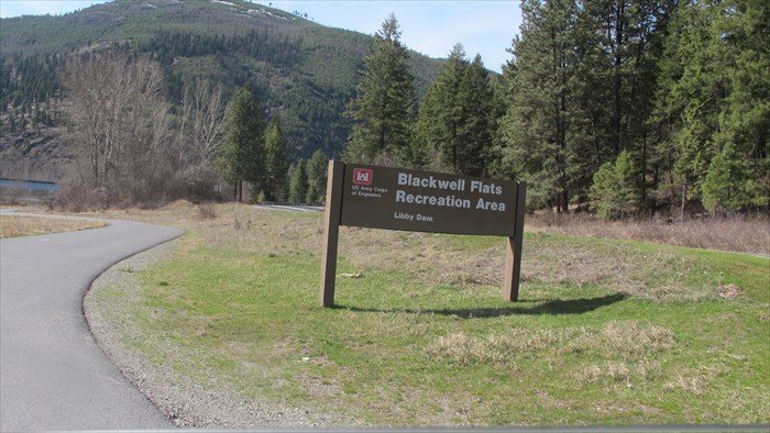
The Blackwell Flats Recreation Area is just north of the bend in the Kootenai to the east of Libby. It is about four miles south of Libby Dam on the west side of the river. Access is via Highway 228, which runs up the west side past the dam all the way to the Koocanusa bridge, well north on the lake. The highway starts just west of the bridge on Highway 37 at the bend.
This is a good sized rec area with paved roadways and several camping spots and a couple of outhouses. There is a small paved parking area at the beginning of the boat ramp and lots more parking available on the grass.
The succession of boat ramps continues north of the dam on Lake Koocanusa, as well.
Blackwell Flats Campground
WEST SIDE OF THE KOOTENAI RIVER!
Blackwell Flats Campground has 7 sites and is located on the West side of the Kootenai River approx 3.5 miles downstream from Libby Dam!
Access from Forest Road 228, 18 miles NE of Libby on Highway 37, then turn north at sign for Libby Dam. Dry camping. There is a boat ramp with day-use parking onsite. No drinking water but vault restrooms. All sites are gravel with some sites pull-through. Table and fire pit at each site. Large rigs will fit in the pull-throughs. Right on the Kootenai River below the dam. Very quiet. Do not use Highway 535 for access. This road is narrow and used by logging trucks that don't know how to slow down! Tour of the dam is available a few miles north of the campground.
From Explore Libby