
Lansdowne Trig, Lansdowne Forest, NSW
Posted by:  T0SHEA
S 31° 45.636 E 152° 32.600
56J E 456753 N 6486008
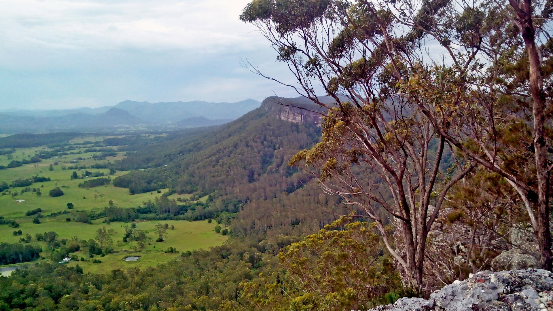
This trig point is about 100 metres west of Lansdowne Trig Road in Lansdowne Forest. It is about 3 km. north as the crow flies from Lansdowne.
Waymark Code: WMN0RK
Location: New South Wales, Australia
Date Posted: 12/03/2014
Views: 6
This trig point stands above a cairn of loosely piled rocks on a wooden 2X2 stake. Its official designation is TS2799. If you want to find a stone cairn, wooden-post trig that is in reasonable condition then THIS is the one for you. Also, this is another trig point with a fine view of the countryside.
Lansdowne Trig Road runs generally north from the trig point for about one km. before hitting Coopernook Forest Way. Head south at this junction and one will eventually hit Bangalow Road. South again here will take one right into the town of Coopernook. The road is a bit much for many 2 WD vehicles, but is no problem for a 4 WD.
State: NSW

Map Name: Coopernook, 9434-3N
Map Scale: 1:25,000
Map Publisher: Central Mapping Authority
|
Visit Instructions:
To log your visit to a waymark, you must post a photo of the Trig Point with your GPSr in it or yourself at the location. Also please describe your visit to the waymark.