Thompson Falls Airport - Thompson Falls, MT
Posted by:  T0SHEA
N 47° 34.676 W 115° 17.079
11T E 628995 N 5270816
The airport is about two miles east of the city of Thompson Falls and south of Highway 200.
Waymark Code: WMMYR4
Location: Montana, United States
Date Posted: 11/25/2014
Views: 2
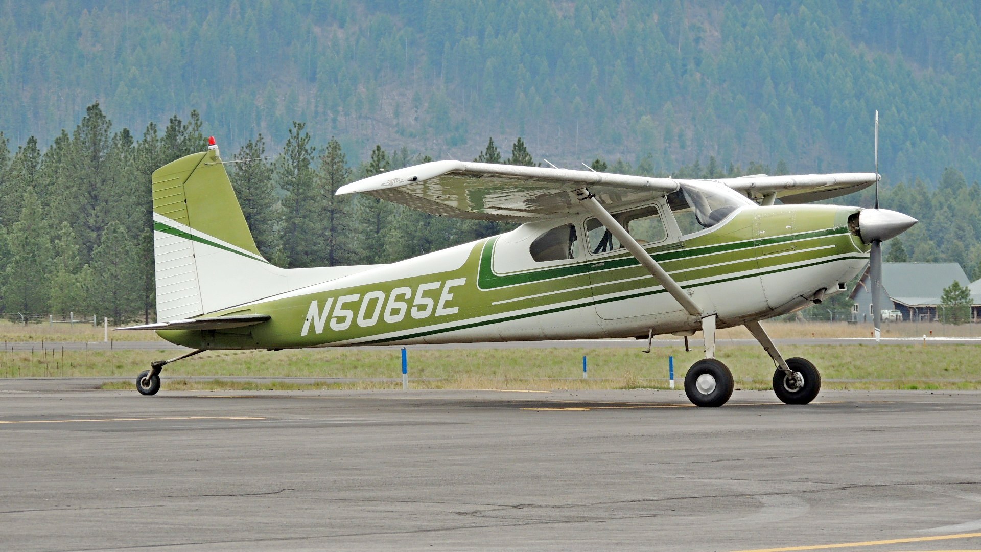
This is a small civil airport with no commercial flights in or out. We counted, I believe, 19 hangers on the airport. The only aircraft outside were a Cessna 180 tail dragger (obviously updated, I noticed it had droop tips) with a two blade prop and a helicopter. There is a nice little pilots' room available, stocked with snacks and drinks and a coffee can for donations. Entry is gained by entering the international distress frequency on the keypad. Fuel is available from a self serve system accessible via the pilots' room. There is a phone in the pilots' room to report problems, summon a taxi, etc.
The airport has a single asphalt runway - 7-25, 4,200 feet in length. Elevation is 2460 feet. AWOS Frequency is 118.325. In 2008, the last year for which statistics are available, there were 7,000 movements, or 19 per day and there were 12 aircraft based at this airport. Seems a lot for an airport of this size. Possibly many of the movements occur during fly ins and such.