
Newburyport Harbor Light - Newburyport, MA
Posted by:  silverquill
N 42° 48.905 W 070° 49.141
19T E 351289 N 4741885
More popularly known as the Plum Island Lighthouse, this light stands at the mouth of the south Merrimack River to the south edge. The current lighthouse tower was built in 1898.
Waymark Code: WMMT7D
Location: Massachusetts, United States
Date Posted: 11/01/2014
Views: 7
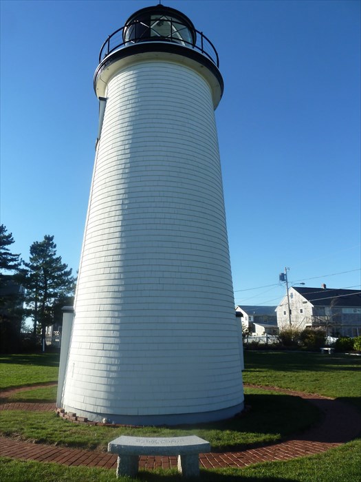
The Newburyport Harbor Light Station is located on the north tip of the barrier Plum Island at the southern mouth of the Merrimack River, giving rise to its more popular name, Plum Island Lighthouse. There are actually no signs identifying the lighthouse, but the grounds are open all year, with free parking. It is open for tours on selected days throughout the year.
The following specifications are from
New England Lighthouses
Station established: 1788
Present tower built: 1898
Automated: 1951
Construction materials: Wood
Other buildings still standing:1898 keeper's house
Tower height: 35 feet
Height of focal plane: 50 feet
Optic: Fourth-order Fresnel lens (1856), still in use (right)
Characteristic: Occulting green light; two eclipses every 15 seconds
A more detailed history can be found from Friends of Plum Island Lighthouse who maintain the light and sponsor special events.