
Cheonbong Mountain Hiking Trailhead - Sangju, Korea
Posted by:  silverquill
N 36° 25.572 E 128° 09.059
52S E 423892 N 4031556
This is the beginning of a trail system that leads over Cheonbong Mountain on the north side of Sangju, Korea.
Waymark Code: WMM2RP
Location: Gyeongsang buk do, South Korea
Date Posted: 07/10/2014
Views: 1
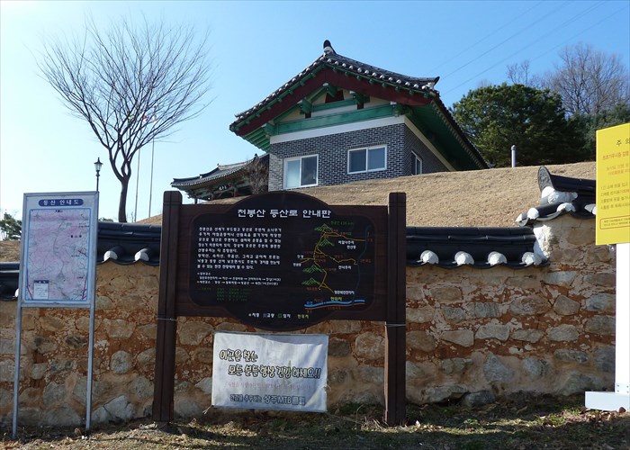
These trail maps mark the trail system over Cheonbong Mountain on the north side of Sangju, Korea. The carved wooden map shows various mountain peaks are illustrated along with lines for the trails. The relief map shows the same trails with the geographic terrain.
The trails start here at the site of the Bukcheon Battlefield where Korean Military and volunteer militia fought one of the first battles of the Imjin War against the invading Japanese force who were ultimately repelled in a decisive naval battle. The trails range from about a mile (1,500m) to a mile and a half (2.341m). One of them leads to a remote Buddhist temple.
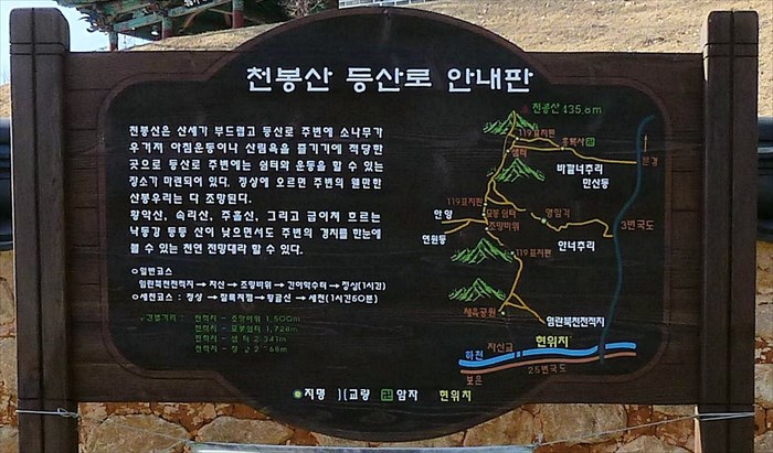
천봉산 등산로 난내판
천봉산은 난세가 부드림고 등산로 주변네 소나무가 우거지 나침운동이나 산림욕을 즐기기에 직당한 곳으로 등산로 주변에는 쉼터와 운동을 할 수 있는 장소가 ㅏ련되어 있다. 정산에 오르면 주변의 오ㅔㄴ만한 난본우리는 다 조망된다.
한낙산, 속리산, 주흘산, 그리고 급이치 흐르는 낙동간 등등 산니 낮으면서도 주변의 경치를 한눈에 불 수 있는 천연 전망대라 할 수 있다.