Top O' the Gulch - Trail, BC
Posted by:  T0SHEA
N 49° 05.475 W 117° 42.362
11U E 448453 N 5437839
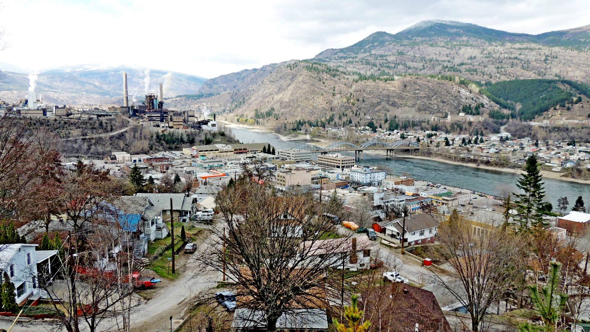
These views are from the Elder hiking trail above West Trail.
Waymark Code: WMM1GK
Location: British Columbia, Canada
Date Posted: 07/02/2014
Views: 2
The Elder Trail starts at N 49° 05.518 W 117° 42.532 on the east side of Palyga Drive. The views were taken a short way east on the trail where there were fewer trees obstructing the view. One view (default) is centered on the Teck (ex Teck Cominco) smelter, which produces zinc, lead, gold, silver and many rare earth metals, another on the old bridge, built in 1911, now unused, while the third (below) is centered on downtown Trail.
The title, "Top O' the Gulch", comes from the fact that at the bottom of West Trail is the commercial area, about three blocks running along Highway 3B, which came to be known as "The Gulch". Above The Gulch the residential section rises steeply for several blocks, up steep winding streets, many supported by handmade rock walls.