
Ottawa-Carleton Trailway - Stittsville, Ontario, Canada
Posted by:  lindeye
N 45° 15.489 W 075° 55.249
18T E 427752 N 5012040
The Stittsville Main Street access point for the Ottawa-Carleton Trailway, part of the Trans Canada Trail.
Waymark Code: WMKEA3
Location: Ontario, Canada
Date Posted: 03/30/2014
Views: 9
The access point for this rail-to-trail is in the heart of Stittsville near the intersection of Main Street and Abbott Street, and located about 9 kilometers from the starting point in Bell's Corners, Ottawa. Limited on-street parking is available on Abbott Street east of Main.
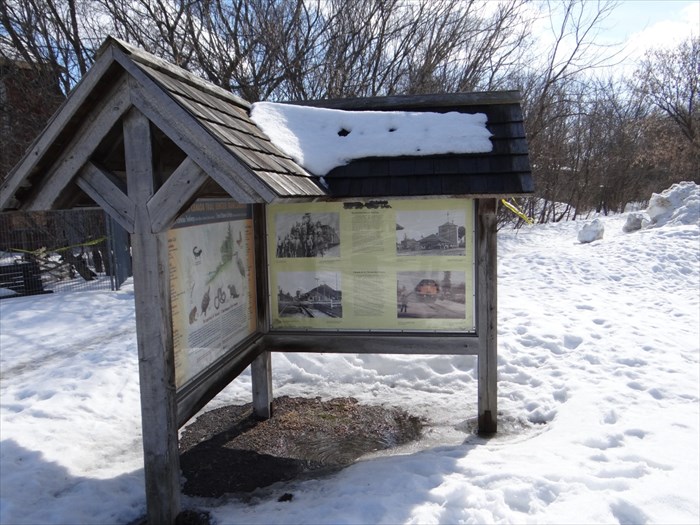
The Ottawa-Carleton Trailway is 23.2 km long with a largely urban environment. The surface is fine gravel with activities including walking/hiking, biking, horseback riding, cross-country skiing, and even snowmobiling in rural areas west of West Ridge Drive. This part of the Trans Canada Trail within Stittsville does not permit horseback or motorized vehicles.
The Canadian Pacific Railway built a line from Ottawa through Carleton Place to Brockville in the 1870s. The first stream train ran through Stittsville on September 16th, 1870 just a month or so after the Great Carleton Fire that devastated the area. The regrowth of the community started here, where the rail line meets Main Street. The last train ran through on January 14th, 1990. The next day CPR began removing the tracks.