Nine Mile Hydroelectric Power Plant - Spokane, WA
Posted by:  T0SHEA
N 47° 46.540 W 117° 32.615
11T E 459275 N 5291510
This hydro dam and plant originally powered an electric railway, as well as a few small local communities.
Waymark Code: WMK5M8
Location: Washington, United States
Date Posted: 02/17/2014
Views: 1
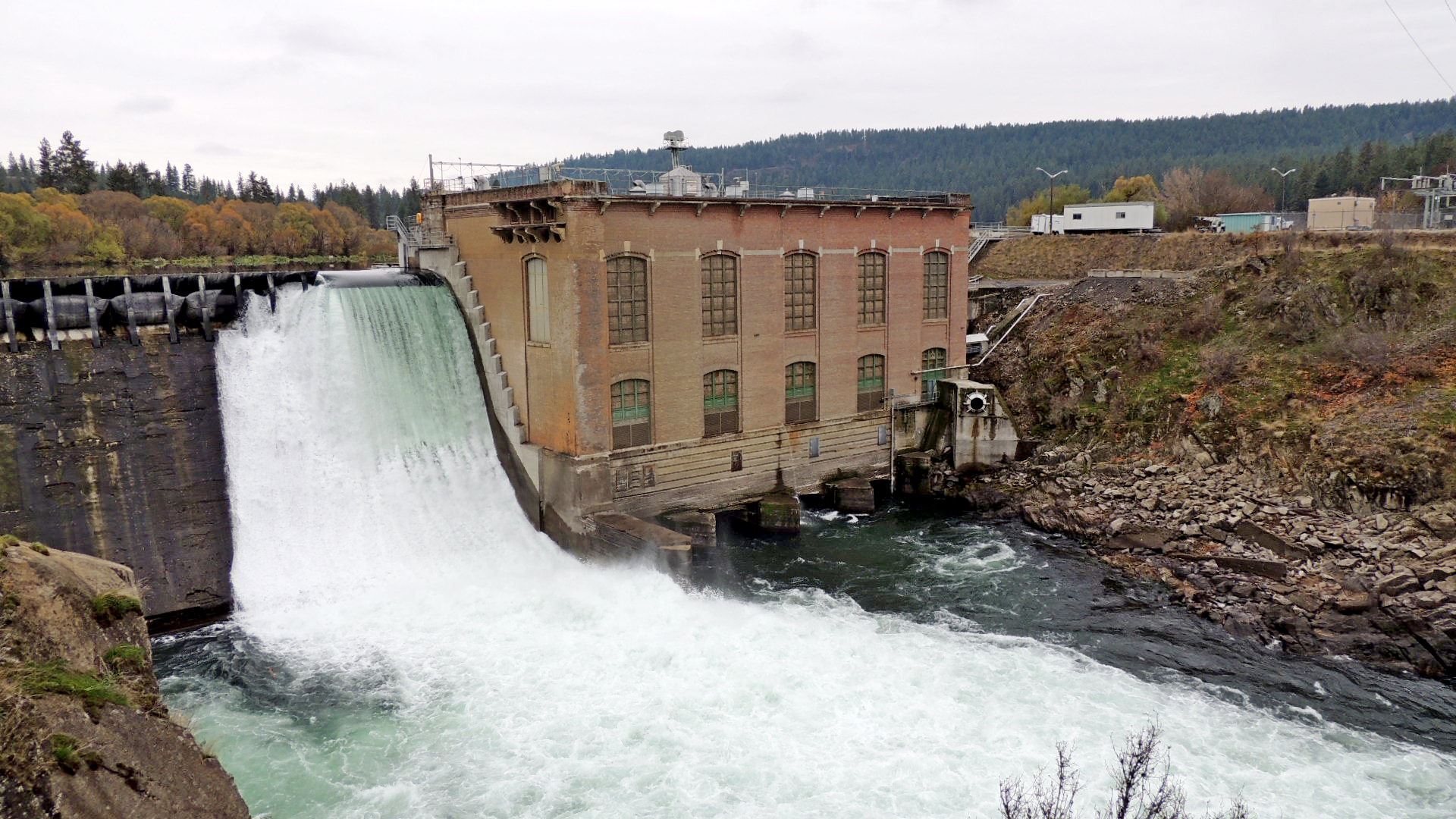
Designed by the firm of Anderson & Porter of New York, Nine Mile Dam was brought to completion in 1908, with construction having begun in 1906. It impounds an area of 420 acres and its usable storage is 4,600 acre-feet. Initially it was intended to supply power to the electric railway of the Spokane & Inland Empire Railroad Company. The Washington Water Power Company purchased it in 1925. The WWPCo is now known as Avista.
The powerhouse is 139 feet long by 116 feet in width and about 120 feet high. The dam is 58 feet high, 67 feet wide at its base and 364 feet long overall, which includes the length of the powerhouse, whose upstream wall and foundation comprise part of the dam. Four gates in the upstream wall of the powerhouse open to turbine chambers that contain 42 inch Francis turbines mounted on horizontal shafts. The turbines are arranged in pairs, with a central discharge draft tube for each pair. They were manufactured by the Holyoke Machine Company and are direct connected to Westinghouse AC revolving field generators operating with a 64 foot head, each with a capacity of 3,000 KW; 3,750 kva; 2,200 volt; 3-phase; 60 cycle.
The Dam was placed on the National Registry of Historic Places in 1990.