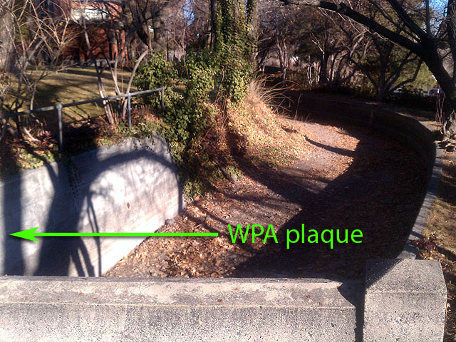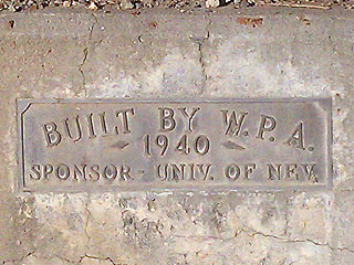
Located on southern portion of the campus of the University of Nevada, Reno is a long, concrete dam and irrigation canal that travels east/west through the campus. On the northern wall on the east side of a bridge that spans the canal is a bronze plaque that reads: 'BUILT BY W.P.A. - 1940 - SPONSOR - UNIV. OF NEV.'. I could not find any other information online regarding the history of the construction of this canal and nearby dam. I spent some time looking on topography maps and Google Maps and noticed that this irrigation canal meanders NE to the Wildcreek Golf Course (providing the small reservoirs with water), then continuing eastward into Sparks, NV where it becomes what is called
Orr Ditch. Orr Ditch continues northeastward until it finally terminates at the Redhawk Private Golf Club, providing water for the small reservoirs located at this course. My hunch is that the WPA constructed the irrigation canal to include Orr Ditch all the way into Sparks, NV.
I assumed that the WPA built the concrete bridges that span this irrigation canal along its way through campus but I found proof that this is not the case. There's a date of '26 imbedded in the sidewalk near the bridge, which tell me the bridge was built before the WPA installed the concrete walls of the canal. The canal itself has held up well over the years with slight erosion of the concrete curbing in specific spots. The dam hasn't held up as well and I noticed much crumbling of concrete along the whole length of Manzanita Lake.