Lawrenceville Municipal Water Tower, Lawrenceville, Virginia
Posted by:  showbizkid
N 36° 45.477 W 077° 50.954
18S E 245655 N 4071807
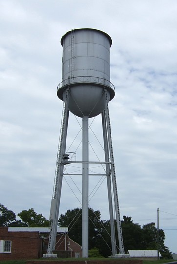
Older, unmarked tank in the county seat.
Waymark Code: WMJR4
Location: Virginia, United States
Date Posted: 07/30/2006
Views: 14
Community pride usually dictates something on a water tower, but Lawrenceville's is uncluttered with the town's name or anything else for that matter. This older tank appears to still be in use.
Coordinates taken from the base.
To record your own visit to this waymark, take and post your own original photo of the waymark, and upload it with your log. Logs must contain the required photo as proof of your visit, please