|
 Ferrata HZS to Martinske Hole - Lesser Fatra, Slovakia Posted by:  Rikitan Rikitan
N 49° 05.278 E 018° 49.659
34U E 341394 N 5439507
Summit register placed on the top of via ferrata hiking trail via Pivovarsky stream to Martinske hole, Lesser Fatra, central Slovakia.
Waymark Code: WMJJP1
Location: Žilinský kraj, Slovakia
Date Posted: 11/25/2013
Views: 20

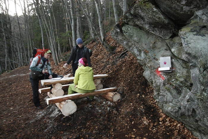
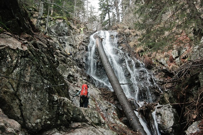
Once you'll climb new via ferrata in beautiful gorge of Pivovarsky stream, Lesser Fatra mountains you can be rewarded by signing of brand new "summit" register.
It is placed in classic metal container, mounted to a big rock. There are new benches with a table right next to the register, so you can sign it comfortably.
Lesser Fatra (Malá Fatra) is a coreal mountain in the north of Slovakia, in the district of Žilina. It is part of the landscape as a whole Fatra-Tatra area, which is part of the Internal Western Carpathians. After the High, Low Tatras and Oravské Beskidy, it is the fourth highest mountain with a rich and relatively preserved west Carpathian nature.
Via Ferrata starts in elevation 930m ASL and it's rated as difficulty B (A = easiest, E = toughest).
200 metres higher trail splits into 2 - straigh one is easier (B) and shorter, more difficult one leads to right across wild waterfall.
Both are leading to one point above the valley next to summit register. So far there are over 400 metres of steal ropes, 80 krampons and 160 fixed points installed.
Available are 3 rest areas with picknick tables and 4 bridges.
View slovak hiking map will help you to plan your trip here.

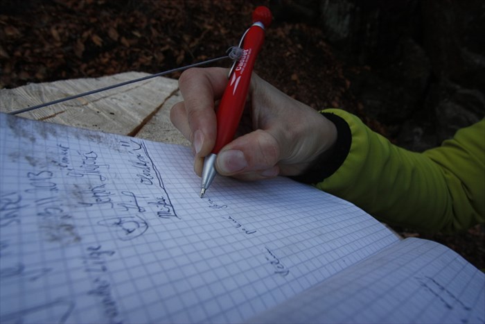
Po zdolani novej via ferraty pod Martinskymi Holami sa mozete zapisat do tejto "vrcholovej" knihy.
Je umiestnena v klasickom kovovom puzdre, ktore je pripevnene o velku skalu na spojke dvoch vetiev zaistenej cesty.
Hned vedla je stol s lavicami, kde si mozete oddychnut.
Ferrata, otvorena v septembri 2013, zacina v nadmorskej vyske 930m.n.m., o dvesto vyskových metrov dalej sa rozdvojuje.
Rovno nahor vedie jednoduchsí variant obtiaznosti B, doprava k velkemu vodopadu vedie narocnejsi variant C.
Obidva koncia na modrej TZT vo vyske cca 1250m.n.m. Na chodniku je zatial pouzitych 410 metrov ocelovych lan, 80 stupaciek a 160 istiacich bodov.
Najdeme tu 3 oddychove miesta s lavickami a 4 premostenia potoka.
Pozrite si turisticku mapu oblasti pre planovanie vasej tury.
Visit Instructions:
Up to the Waymark owner
|