
Spokane River Bridge at Long Lake Dam - Reardan, WA
Posted by:  T0SHEA
N 47° 50.381 W 117° 51.128
11T E 436238 N 5298833
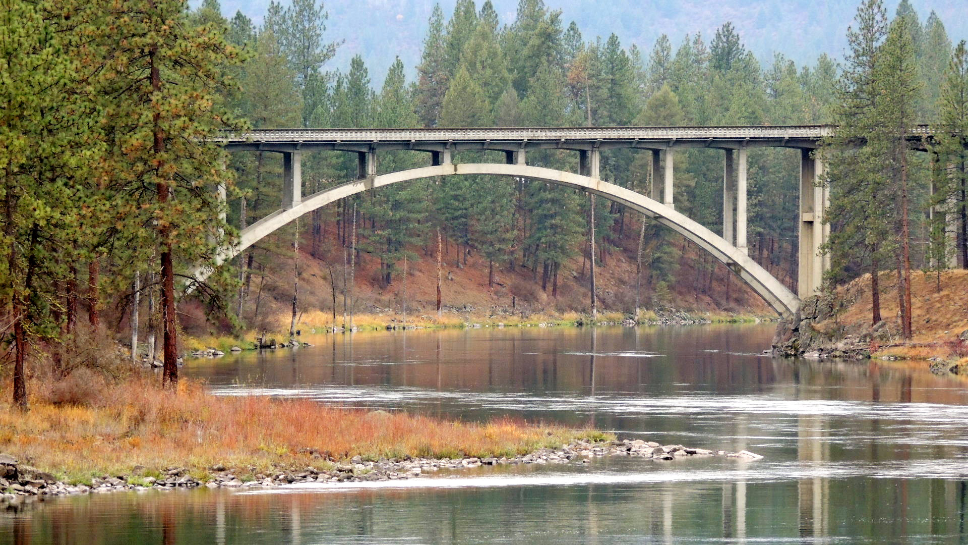
This Spokane River Bridge carries Highway 231 over the Spokane River just downstream of the Long Lake Dam, connecting Lincoln and Stevens Counties.
Waymark Code: WMJGG1
Location: Washington, United States
Date Posted: 11/15/2013
Views: 3
The longest concrete arch built in Washington in the 1940s, this bridge was built in 1949 by the Washington State Department of Transport. Its total length is 481 feet with a 211 foot long open spandrel arch span in the centre. The concrete arch section consists of two reinforced concrete ribs spanning 200 feet between skewbacks, rising 44 feet with an overall length of 211 feet. The ribs support columns spaced 23 feet apart, which in turn support the roadway girders, floor beams, and roadway slab.
The bridge is unique for its use of a a considere hinge, the only one built in Washington in the 1940s employing this system.
The bridge was listed on the National Register of Historic Places in 1995.
Length of bridge: 481 feet

Height of bridge: 44 feet
What type of traffic does this bridge support?: motor vehicles
What kind of gap does this bridge cross?:
Spokane River
Date constructed: 1949
Is the bridge still in service for its original purpose?: Yes
Name of road or trail the bridge services: State Highway 231
Location:
Lincoln & Stevens Counties
|
Visit Instructions:
Please submit a photo(s) taken by you of your visit to the location (non-copyrighted photos only). GPS photos are also accepted with the location in the background, and old vacation photos are accepted. If you are not able to provide a photo, then please describe your visit or give a story about the visit. If the bridge location prevents you from taking a safe photograph, then please do not stop to take the photo. Safety is more important.
Recent Visits/Logs:
| There are no logs for this waymark yet. |
|
|
|