CYCLO M-5155C Nova Bana, Lidl - Slovakia
Posted by: Groundspeak Premium Member Rikitan
N 48° 25.281 E 018° 38.553
34U E 325587 N 5365818
Cycling signage post with 4 direction & distance slats, located in front of Lidl store in Nova Bana, central Slovakia.
Waymark Code: WMJDDM
Location: Banskobystrický kraj, Slovakia
Date Posted: 11/03/2013
Published By:Groundspeak Premium Member puczmeloun
Views: 13


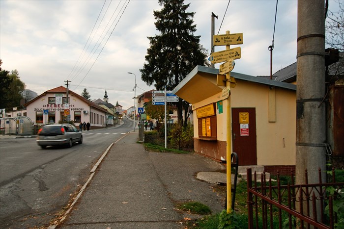
Cycling Direction and distance arrows in town Nová Bana, by Lidl store in altitude 221 metres ASL contains 4 direction signs with distances to 9 different destinations by two different cycling trails:
  • blue trail: M-2454C Pila - Nova Bana - Mala Lehota, 44.5km
  • green trail: M-5155C Hronsky Benadik - Nova Bana - Velke Pole, 30.5km
Arrows are part of complex system of cykling signage in Slovakia, installed by Club of Slovak Tourists in year 2006. These routes are part of Pohronske cyklotrasy system.


Slovak description:

Cykloturisticky razcestnik Nova Bana, Lidl sa nachadza v nadmorskej vyske 221 metrov v centre mesta Nova Bana. Ma 4 smerove tabulky k 9 rozlicnym turistickym cielom - Novou Banou prechadzaju dve cyklotrasy siete Pohronskych cyklotras - modra M-2454C a zelena M-5155C.

Razcestnik bol osadeny Klubom slovenskych turistov v roku 2006.


Date placed: 01/01/2006

Historic significance:
Arrows are part of complex system of cycling signage in Slovakia, installed by Club of Slovak Tourists.


Location nearest to where you live now:
Mala Lehota


Visit Instructions:
To log an existing waymark in this category, please describe why you visited this marker, provide a photograph of the marker (preferably with yourself or a friend) of the marker, and list the "arrow" that comes closest to where you live now.
Search for...
Geocaching.com Google Map
Google Maps
MapQuest
Bing Maps
Nearest Waymarks
Nearest Direction and Distance Arrows
Nearest Geocaches
Create a scavenger hunt using this waymark as the center point
Recent Visits/Logs:
There are no logs for this waymark yet.