|
 Velky Inovec, summit - Pohronsky Inovec, Slovakia Posted by:  Rikitan Rikitan
N 48° 24.602 E 018° 32.618
34U E 318229 N 5364790
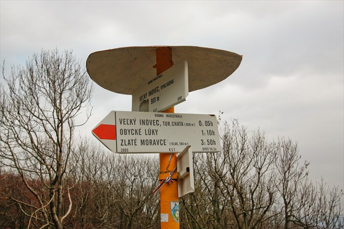
Hiking signage post with 2 direction & distance slats, installed on the top of Velky Inovec mountain, central Slovakia.
Waymark Code: WMJDDC
Location: Banskobystrický kraj, Slovakia
Date Posted: 11/03/2013
Views: 13

Direction and distance arrows - Velky Inovec, summit - stands on the top of Velky Inovec mountain in altitude 901m ASL.
It contains 2 hiking direction signs with distance (in walking time) to 6 different destinations, marked by red hiking trail:
Arrows are part of complex system of hiking signage in Slovakia,
installed by Club of Slovak Tourists in year 2005.
Red trail is part of long distance hiking trail called Rudna magistrala.
 Slovak description:
Smerovnik Velky Inovec, vrchol sa nachadza v nadmorskej vyske 901 metrov na vrchole Velkeho Inovca.
Ma len 2 smerove tabulky k 6 rozlicnym turistickym cielom, ku ktorym vedie cerveno znacena trasa (uvedene vyssie), ktora je aj sucastou dialkovej turistickej trasy Rudna magistrala.
Razcestnik bol osadeny Klubom slovenskych turistov v roku 2005.
Date placed: 01/01/2005

Historic significance:
Arrows are part of complex system of hiking signage in Slovakia, installed by Club of Slovak Tourists.
Location nearest to where you live now:
Zlate Moravce
|
Visit Instructions:
To log an existing waymark in this category, please describe why you visited this marker, provide a photograph of the marker (preferably with yourself or a friend) of the marker, and list the "arrow" that comes closest to where you live now.
|