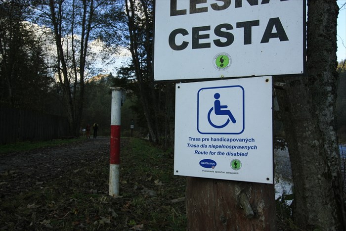
 Wheelchair-accessible hiking trail
 in
Bielovodska valley is
one of a 8 trails for people, who are disabled in surroundings of
High Tatras mountains, Slovakia.
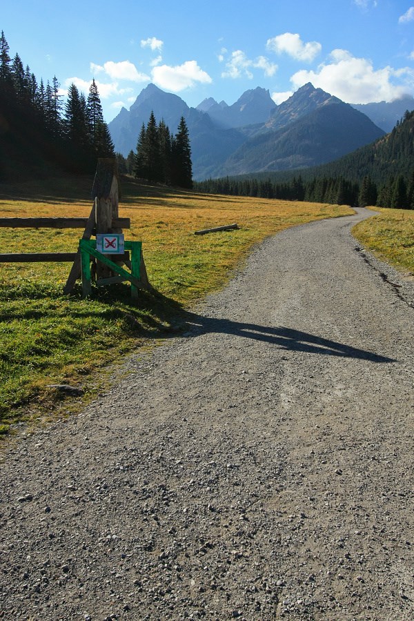
All of us can enjoy the trip to the heart of beautiful nature by this, approx. 4-kms long trail.
It starts in small settlement of Lysa Polana (bus stop, parking lot, restaurant and hostel) on the border with Poland.
You can preview the trail on
this map. It is possible to continue even further by the road.
No vehicles (apart from bicycles) are allowed to use the road in valley. Its surface is made of asphalt at the beginning, after few kilometres it turns to fine gravel.
There are several places for rest, picnic tables, natural springs in the valley - with nice view to highest peaks of High Tatras mountains.
Jednou z momentálne osmych turistických trás pre handikepovaných vo Vysokých Tatrách a ich okolí je asi 4km dlhá trasa v
Bielovodskej doline.
Vedie po modro znacenom turistickom chodniku z Lysej Polany po horaren Biela voda (studnicka, piknikove stoly, zaver cyklotrasy).
Je mozne pokracovat aj dalej v ustrety stitom, az kym sa lesna cesta nezacne dvihat niekde v okoli horolezeckeho taboriska.
Z cesty je samozrejme vylucena (takmer) vsetka doprava, obcas tadialto prejde cyklista. Povrch je spociatku asfaltovy, neskor prechadza v jemnu sotolinu, az udupanu hlinu.
Pre lepsi prehlad si mozete pozriet trasu na
tejto mapke.