Columbia Trail North Trailhead - Champion Creek, BC
Posted by:  T0SHEA
N 49° 14.194 W 117° 39.271
11U E 452354 N 5453960
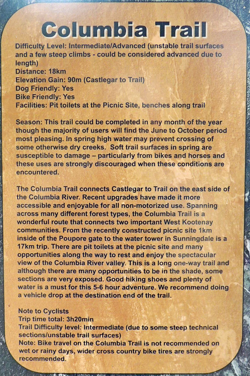
This is the north end of a biking trailhead that runs for 18 km. between Champion Creek, south of Castlegar, and East Trail, south on the Columbia River.
Waymark Code: WMJ9TT
Location: British Columbia, Canada
Date Posted: 10/16/2013
Views: 2
To arrive at this trailhead one must follow Columbia Road south from Highway 3 directly south of the Castlegar Airport. The road is paved as far as a large gravel pit, then gravel for the final few km. One will eventually encounter a yellow gate and a small parking lot. The trailhead is immediately south of the gate.
Improvements have been made to the trail over the years, though it is noted that the trail is not recommended for cyclists in wet weather, due to slippery sections. There is a picnic area and washrooms 2 km. south of the trailhead, at the site of the old Champion Creek Doukhobor settlement, just north of the old, abandoned cemetery.
The trail is managed and maintained by the Castlegar Friends of Parks and Trails Society, whose website contains information on the many trails in the Castlegar area.