|
 Placlivô - Western Tatras, Slovakia Posted by:  Rikitan Rikitan
N 49° 11.852 E 019° 44.897
34U E 408809 N 5450168
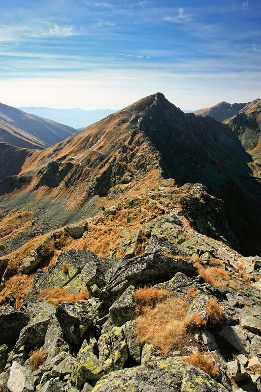
Placlivô (2,125 metres / 6,972 feet ASL) is notable sharp peak in the main ridge of Western Tatras mountains, Slovakia. It is accessible by several hiking paths and trails.
Waymark Code: WMJ8K8
Location: Žilinský kraj, Slovakia
Date Posted: 10/11/2013
Views: 16

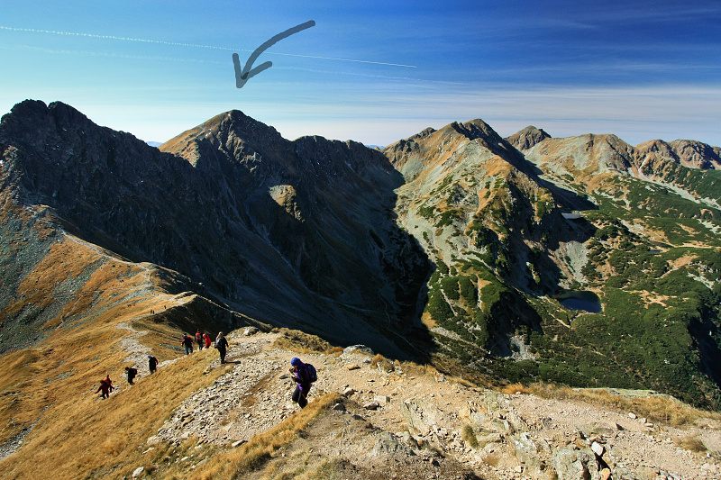 Placlivô
 (or Placlivé / Placlivý Rohác, can be translated to english as Crying Peak) is notable sharp peak of Western Tatras mountains, Slovakia.
Like a twins, Ostrý Rohác and Placlivô are towering above Rohácska valley, giving to this part of the mountains their characteristic shape.
Its summit is located on the main ridge of the mountains in elevation 2,125 metres / 6,972 feet.
Routes:
Placlivo can be reached from three directions using marked hiking trails - either by hike of main ridge of the mountains from west to east (40 minutes for Smutne sedlo, red trail) or vice versa, or from Ziarske saddle (30 minutes, yellow-marked trail).
Very popular are round-trails from two valleys:
- Rohacska dolina (north)
- possible only in summer season (15 June - 31 October)
- Ziarska dolina (south)
- accessible all year round
View slovak hiking map, it will help you to plan your hike here.

 Placlivô
 (resp. Placlivé, Placlivý Rohác - 2,125 m.n.m.) je výrazný vrchol na hlavnom hrebeni Západných Tatier - Rohácov.
Spolu so susedným Ostrým Rohácom tvoria charakteristické dvojicky, ktoré sa majestátne vypínajú nad Rohácskou dolinou.
Pristup:
Hrebenovka cerveno znacenou turistickou trasou je velkym zazitkom.
Velmi popularne su tiez okruzne trasy z dolin:
- Rohacska dolina (Slovakia)
- okruh cez Smutne sedlo, Placlivo, Ostry Rohac a Volovec
- Ziarska dolina (Slovakia)
- okruh zo Ziarskej doliny cez Ziarske sedlo, pristupny celorocne
Pozrite si turisticku mapu oblasti pre naplanovanie vasej tury.
Altitude in Feet: 6972

|
Visit Instructions:
To post a visit log for waymarks in this category, you must have personally visited the waymark location. When logging your visit, please provide a note describing your visit experience, along with any additional information about the waymark or the surrounding area that you think others may find interesting.
We especially encourage you to include any pictures that you took during your visit to the waymark.
|