 Gerlachovský štít
 (trans. Gerlach Peak) is the highest peak in the High Tatras, in Slovakia, and in the whole 1,500 km (930 mi) long Carpathian mountain chain,
as well as in northern and eastern Central Europe. Usually listed at 2,655 metres AMSL (8,711 ft), its exact elevation is actually 0.6 metres (2 ft) lower.
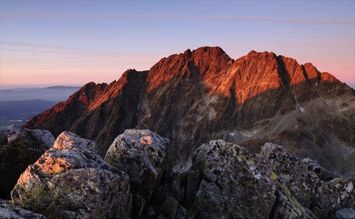
The pyramidal shape of the massif is marked by a huge cirque.
Despite its relatively low elevation, the about 2,000 m vertical rise from the valley floor makes Gerlachovský štít soar.
Mistaken for an average mountain in the rugged High Tatras range in the more distant past,
it has since played a symbolic role in the eyes of the rulers and populations of several Central European nations,
to the point that between the 19th and mid-20th century, it had four different names with six name reversals.
It managed to be the highest mountain of the Kingdom of Hungary, and of the countries of Czechoslovakia and Slovakia within the span of only about two decades of the 20th century.
Access:
Only members of a national UIAA club are allowed to climb the peak on their own.
Other visitors have to take a certified mountain guide. Usual price is 250 Euro per 2-3 persons, depending on conditions and selected route.
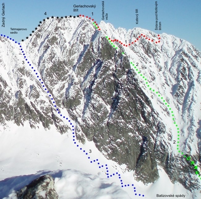
The two easiest routes, usually up the
Velická próba and down the
Batizovská próba named after their respective valleys, are protected by chains.
Because of an exposed section along the
Velická próba and tricky orientation especially on the ridge, both are among the more difficult scrambling routes in the High Tatras, although it's rather climbing, since there are many moments when one must rely on ones hands to hold ones bodyweight.
With no snow, guidebooks grade the routes as a II or III climb (UIAA scale) or lower. The total elevation gain is about 1,000 m (3,300 ft) for those who spend the night at the Sliezsky Dom Hotel or are driven there by a mountain guide, and about 1,665 m (5,460 ft) for those who hike from Tatranská Polianka.
In winter, Gerlachovský štít offers a challenging alpine climb, with mixed climbing and a risk of avalanches.
Gerlachovský štít (hovorovo Gerlach) je najvyšší vrch Tatier, Slovenska aj celých Karpát.
Názov je odvodený od obce Gerlachov, nad ktorou je situovaný a patril i do jej chotára.
Leží v juhovýchodnej rázsoche Zadného Gerlachu, od ktorého ho oddeluje Gerlachovské sedlo.
Z vrcholu pokracuje hreben na Kotlový štít, kde sa rozvetvuje a vytvára známy Gerlachovský kotol.
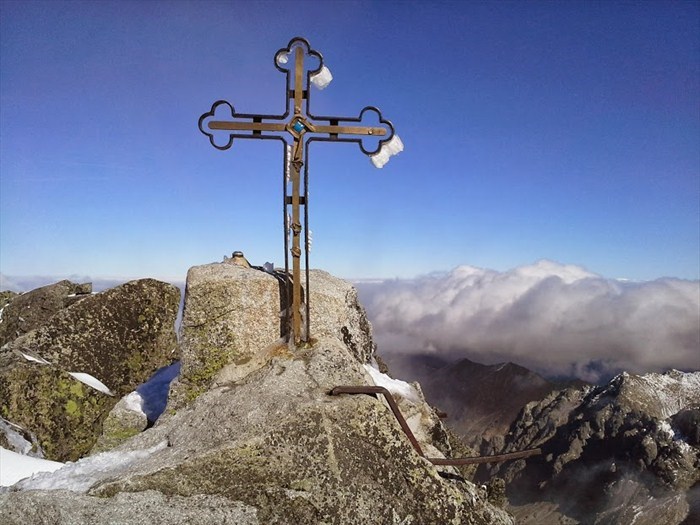
Gerlachovský štít je pre svoju výšku, dostupnos a krásnu horskú scenériu jedným z najnavštevovanejších vrcholov.
Prístup:
Len clenovia horolezeckého spolku IAMES mozu na vrchol Gerlachu vystupit na vlastnu past, to je dané aktuálne platným návštevným poriadkom TANAPu.
Využi pri tom môžu lezeckú cestu obtiažnosti 3 a viac. Ostatní turisti musia využi služby certifikovaného horského vodcu.
Obvyklá cena za jeho služby je 250 eur, vzia môže 2-3 osoby podla aktuálnych podmienok a zvolenej trasy.
Dve najjednoduchšie cesty - výstupová Velická próba a zostupová Batizovská próba, sú pomenované podla dolín, odkial vychádzajú a na viacerých miestach zabezpecené reazami.
Obidvomi však vedú trasy skôr lezeckého ako turistického charakteru, treba poèíta s využitím rúk a balansu tela.
V období bez snehovej pokrývky je ich možno oznaci stupnom II až III medzinárodnej stupnice UIAA.
Celkové prevýšenie od Velického plesa (horský hotel Sliezsky dom) je približne 1,000 metrov, respektíve 1,665 metrov z Tatranskej Polianky.
V zime poskytuje Gerlachovský štít podmienky pre nárocnú vysokohorskú túru s mixovým lezením a rizikom strhnutia lavíny.