
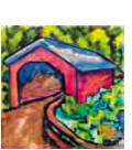
Kurtz's Mill Covered Bridge - Lancaster, PA
N 40° 00.912 W 076° 16.940
18T E 390563 N 4430231
Washed out by Hurricane Agnes in 1972 & moved, this bridge no longer serves its original vehicular traffic which spanned the Conestoga Creek. Today, the bridge spans Mill Creek in Lancaster Central Park in West Lampeter Township.
Waymark Code: WMJ0KV
Location: Pennsylvania, United States
Date Posted: 09/05/2013
Views: 5
 .....
.....
 .....
.....
 .....
.....
 .....
.....
 .....
.....
 .....
.....
 .....
.....
This is but one of an endless amount of covered bridges in Lancaster County, a place replete and famous for such things. The bridge was built in 1876 by W. W. Upp over the Conestoga Rive and is the typical Burr-arch truss bridge found in the other Lancaster County covered bridges. The bridge's length is 90 feet and is entirely constructed of wood. The bridge is in a lovely wooded area of the park; there are restrooms, picnic tables, and parking lots nearby. If you were smart and brought a picnic, have it here; if you were really smart and brought bikes, leave the car here. On June 23, 1972 Hurricane Agnes pulled into town and picked up the bridge and washed it it downstream where it was eventually stopped by a tree. Once all the pieces and parts were collected, The bridge was moved a total of 15 miles away where it still sits today. New abutments were installed resting the bridge much higher and safer over the water. Because the bridge was moved, this might be why it is the only Lancaster County bridge not included on the NRHP, Despite its mid-19th century construction date.
According to the historical marker located on site, the bridge was originally located near unincorporated Hinkletown, part of Earl Township within Lancaster County, PA. I scanned the area using GoogleEarth and found the snake-like Conestoga River and a few likely places where the bridge was originally located. I could find nowhere or the internet information about the original location until I changed my search query and used Earl Township, PA Kurtz's Mill Covered Bridge whereby I stumbled upon a SITE documenting past and present bridges. I was provided with additional clues: At the old site, a 101' long three arch stone culvert was built by A. Genovese, Incorporated for $118,000.00 in 1973.. Using GoogleEarth I determined the only place the bridge could have been located which fits all descriptions and clues is @ Original Location N 40° 8.992 W 76° 8.516. One can see using satellite imagery where the bridge was in 1972. As indicated, the bridge traveled approximately 19.9 miles (sources indicate it was an approximation of 20 miles). Linearly speaking, the bridge moved 11.90 miles southwest, 218°.
There is an historical marker located at the bridge which reads
COUNTY PARK COVERED BRIDGE
Originally Built 1876 and Spanned the Conestoga
Creek Near Hinkletown Damaged in June 22, 1972
Flood and Relocated to This Site in 1974. Rebuilt
And Opened for Public Use 1975.
Below this is a list of names like commissioners, engineers and stiff like that who used the public monies to pay for the extra dough it cost to inscribe their name in this marker.
And so, without further ado, here is a list of my seven waymarks, in descending category order, now all new with HOT LINKS.
02. Kurtz's Mill Covered Bridge - Lancaster, PA
05. Kurtz's Mill Covered Bridge - Lancaster, PA
06. County Park Covered Bridge - Lancaster, PA
08. Shuts Environmental Library - Lancaster, PA
10.
Kurtz's Mill Covered Bridge - Lancaster, PA
13. Kurtz's Mill Covered Bridge - Lancaster, PA
14. Kurtz's Mill Covered Bridge - Lancaster, PA
* Listings reflect new department-category alignment.
01. Animals
02. Buildings
03. Business
04. Culture
05. Entertainment
06. History
07. Measurement Standards
08. Monuments
09. Nature
10. Oddities
11. Recreation
12. Signs
13. Structures
14. Technology
15. Waymarking Multifarious