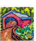
Duo Seeks Help Preserving Herr's Mill Covered Bridge - Ronks, PA
N 40° 00.574 W 076° 09.720
18T E 400824 N 4429465
This orphaned bridge is not in great shape. This article tells of a local couple's initiative to try and renovate and protect the bridge.
Waymark Code: WMHZV6
Location: Pennsylvania, United States
Date Posted: 09/02/2013
Views: 2

Recently, there were big plans in the works to make this bridge workable. Efforts were underway to illuminate the bridge and raise it higher to protect it from flooding. There is also an effort to gain corporate sponsorship to offset the 50K needed for the project, and that is just for raising the bridge and not the other planned endeavors. The outside could be used to promote, "in an historically sensitive fashion," Guest said, the bridge's major benefactors, while inside, painted panels would reflect Lancaster County history and culture. Each panel would be sponsored by local attractions. Guest said he already has spoken to the Pennsylvania College of Art & Design, which might be willing to allow students to help create the panels.
The bridge is fairly typical in design and color of what you would find in Lancaster County's covered bridges with a few notable exceptions. This bridge is very long, longer than most and has two sides for both traffic lanes. I have never seen one of those before. The other oddity is the bridge appears to be private. One side was closed with warnings posted on the entrance about how unsafe it is due to age and buckling wood floor boards. The other end has a flimsy, plastic, orange 'fence' blocking the opening. At the far end, away from the entrance was farm equipment being stowed away for the winter.
This is Amish country so I was behind some horse-drawn wagons for a time. If you look on GoogleEarth, you'll see farmlands forever. The property this is on is a farmstead. Across the creek is a beautiful, functioning waterwheel. at first, I thought this site was a state or local park with the way it is set up. Whatever it is park on the dirt road near the side that is open. The Lincoln Highway is .4 mile from here. I only found this because there was a detour and I was forced to travel south, then west to avoid a section of the Lincoln that had been closed.
My good buddies at Wikipedia tell me Herr's Mill Covered Bridge was built in 1844 by Joseph Elliot and Robert Russell at a cost of $1787. It has a double-span, double-arch Burr arch truss construction. In 1875 the bridge was rebuilt by James C. Carpenter at a cost of $1860. The bridge was later bypassed by a new concrete bridge and is now on the private property of the Mill Bridge Village Camping Resort. In 2006, after plans to demolish the bridge were reported, owner Brian Kopan was quoted as saying "The bridge is in fine condition. We’re hoping to keep it as it is."
Dimensions
Length: 178 feet (54.3 m) total length
Width: 15 feet (4.6 m) total width