
Mount Ouray (13,971) - Colorado
N 38° 25.366 W 106° 13.485
13S E 393088 N 4253432
This peak rises above the Arkansas River valley to an elevation of 13,971 feet at the southern end of the Sawatch Range.
Waymark Code: WMHWQX
Location: Colorado, United States
Date Posted: 08/20/2013
Views: 2
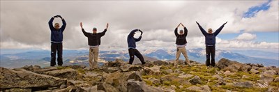
Summit panorama on Mt. Ouray (click to enlarge)
Named for the Ute Indian Chief Ouray, this mountain summit rises prominently from Marshall Pass southwest of the town of Salida. At 13,971 feet, it falls just shy of the 14,000 foot mark that many of Colorado's high peaks are known for, but ranks as the 5th highest 13er and 58th highest summit in the state. In the late 1800's hikers would ride the Denver & Rio Grande railroad to the summit of Marshall Pass to climb Mt. Ouray.
The most popular ascent to Ouray begins at the Marshall Pass trailhead and follows the Continental Divide for 1.5 miles before climbing east to the summit. There is no well-marked trail but the route is obvious as it climbs along the ridgeline. This route is rated class 2 and gains over 3,200 feet over 3 miles.
Alternate routes ascends the east and northeast ridges from Grays Creek. The east ridge route is gentler but longer and gains 4,300 feet in 4 miles. This approach offers a glimpse into the massive cirque on Ouray's east face known as the "Devil's Armchair."
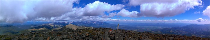
Looking North
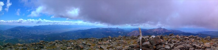
Looking South
Source: Roach, Gerry, and Jennifer Roach. Colorado's Thirteeners, 13,800 to 13,999 Feet: From Hikes to Climbs. Golden, CO: Fulcrum Pub., 2001; SummitPost.org; 13ers.com