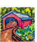
Farther on the OLD COVERED BRIDGE (2), known also as Thomas Mill Road Bridge - relic of a day when the valley was the industrial center of Philadelphia leans uncertainly over the water. Its dim recesses, lighted here and there by sunlight sifting through openings near the roof, conjure up the shades of long-departed pioneers. --- Pennsylvania: A Guide to the Keystone State, 1940; page 615
The Thomas Mill Bridge, built in 1855, incorporates a Howe Truss in its construction and has the traditional wooden planks which are set in as a crosswise plank pattern. There are stone abutments on either end as well as wingwalls to complete the portals. I also spied shingles laid on wide sheets of board, perhaps plywood? The bridge is a single span only open to pedestrian traffic only and is 86½ feet long (26.4 meters) and 18.66¾ feet wide (5.69 meters). Safe access to the stream where are manner of adult and child play can only be had from the east end of the bridge where there are several small trails leading down to the water near the bridge.
The sides are of course covered with typical barn red, vertical board and batten siding. The portals are also painted red instead of the usual white I have seen in other counties. The portals also display a weird looking saw tooth design as well. The rushing water here affords a much better view than any other covered bridge I have ever visited yet sadly, no windows were built into the bridge. Unfortunately its builder is unknown. In 1939, the bridge was rebuilt as part of the Works Progress Administration. The rebuilding of bridges seem to be the case with many of the covered bridges in southeastern PA, although not usually with the Works Progress Administration. In 1999, It underwent a $420,000.00 rehabilitation which included a new stainless steel roof, deck, siding, and repairs to the beams at each of the four corners at the abutments. Additional information about the restoration project can be found HERE
The bridge was added to the NRHP on December 1, 1980 add charms and beauty to this valley. The bridge is also a Contributing Property of the Chestnut Hill Historic District.As stated this is a bridge of ONLYS and LASTS as in the only covered bridge within the city limits of any major U.S. city and the last covered bridge within the city limits of Philadelphia. While these things are definitely a site to see they are becoming more rare each year due to arson, vandals and other nature. The true reason for covering bridges was to extend the life of the bridge by protecting the side supporting timbers (not necessarily the floorboards) from exposure to the weather, thus lowering maintenance costs of the bridge. Beauty had nothing to do with the original design of these covered bridges, but, today it is all that matters (well that and structural integrity).
Location
I truly consider this bridge a best kept secret; how else can you explain why it has never been waymarked yet every other covered bridge in the immediate region has been done to death. There are several ways to get here and none of them are good. I Came in from a playground almost half a mile away and walked well over a mile to get there. Eventually, if you can traverse the huge boulders and loose rocks of shale, schist, quartz, granite and all other manner of metamorphic, sedimentary and igneous rocks and make it down to stream level. Then there is the matter of walking on the hard packed road which is easy enough; it's just getting there is difficult. The Wissahickon Valley is ripe for about 5 or so earthcaches and is known as one of 600 National Natural Landmarks of the United States. A tremendous variety of geology is evident along Wissahickon Creek. Three of the geologic regions that the stream passes through are the Newark Basin of Triassic sandstone and shale, the limestone and dolomite of the Chester Valley, and the Wissahickon Formation where the waters of the stream flow into the Schuylkill and eventually the Delaware Rivers.
Getting back was a nightmare and I got lost for about 40 minutes and all together hiked about 2 miles. A number of trails climb out of the valley from Forbidden Drive to the "upper trails" which run along the precipitous walls of the valley. Many of these upper trails have been marked with colored blazes. The green blazed trail has been designated a multi-use trail approved for mountain bikers with permits. The blue blazed trail has been designated a hiking trail only. All trails in the Andorra Natural Area are prohibited to all bicycles. I was just worried about making it out alive!
Forbidden Drive, also known as Wissahickon Drive, is the gravel road which follows the Wissahickon Creek from Lincoln Drive to the County Line and is the most popular point of access to explore the stream valley. Originally known as Upper Wissahickon Drive, it received its current name in the 1920s when automobiles were first banned from the road. As stated above, Forbidden Drive is the only trail open to bicyclists and equestrians without a permit. SOURCE
I made a video of a walk-through so visitors to this waymark can also do a virtual visit to the covered bridge as well. That video is hosted on YouTube and can be found HERE