Clear Lake, California
Posted by: Groundspeak Regular Member Bernd das Brot Team
N 39° 05.677 W 122° 48.041
10S E 517236 N 4327295
One of the largest lakes in California
Waymark Code: WMH9V8
Location: California, United States
Date Posted: 06/12/2013
Published By:Groundspeak Premium Member tmob
Views: 4

California's Clear Lake is one of the largest lakes in the state and perhaps the oldest lake in North America, having an uninterrupted sediment history of almost half a million years (480,000 years to be precise).


Mount Konocti

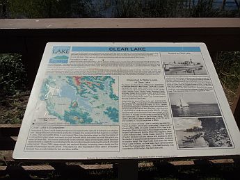
Given the tremendous age of the lake, it is hard to pinpoint its geological type. There have been tectonic influences, as the lake bed is crossed by several fault lines. Mount Konocti, an extinct volcano at the south shore (see picture above) also indicates a volcanic influence.

Mount Konocti's last eruption about 10,000 years ago caused a landslide, cutting the then much larger lake in half and separating Clear Lake from a group of smaller lakes, now called the Blue Lakes.

Today, the lake is fed by snow melt from the Sierra Nevada running into the lake in a number of streams.


All pictures have been taken at or near Alpine Park, a small park at the eastern shore.

Lake Type: Tectonic lake

Coordinates location: Alpine Park, Lucerne, California

Max. Length: 19 mi (31 km)

Max. Width: 8 mi (13 km)

Max. Depth: 60 ft (18 m)

Surface area: 68 sq mi (180 km2)

Website: [Web Link]

Parking / trail head: Not Listed

Visit Instructions:
To log a visit to a waymark, please post a photograph taken by you and a brief description of your visit.
Search for...
Geocaching.com Google Map
Google Maps
MapQuest
Bing Maps
Nearest Waymarks
Nearest Natural Lakes
Nearest Geocaches
Create a scavenger hunt using this waymark as the center point
Recent Visits/Logs:
There are no logs for this waymark yet.