
Words Behind the Picture
Of all the pictures I have seen of Gettysburg, this has to be the most iconic. Simply Google Trostle farm and the famous picture of the dead horses in the foreground with the barn in the background will be splashed across dozens of Civil War-Gettysburg pages. I'd say it rivals the Dunker Church photo taken in Sharpsburg, MD 10 months earlier.
The photo captures the events which occurred on July 2, 1863. The actual photo was probably taken a few days after the battle ended and the Confederates retreated in defeat. Here's what happened: On July 2, 1863, Major General Daniel Sickles (who was later was seriously injured, near the Trostle barn, by a Confederate shell, which caused his leg to be amputated) moved his troops to an exposed position on Emmitsburg Road. Due to mounting pressure by the Confederate Army, the Union troops began retreating from the area of Peach Orchard. Their goal was to make it to Cemetery Ridge. The path of their retreat included the farm lane, noted above, located on the Trostle Farm. Most of the batteries were able to reach the ridge. One exception was the "green" 9th Massachusetts Light Artillery Battery. This was to be their first battle. Captain John Bigelow commanded this battery. Captain Bigelow sustained severe wounds to his side and hand during the battle at the Trostle Farm. Reportedly the troops took cover in the Trostle building, waiting for the ranks of the Rebel Army to get closer. As the enemy troops approached over the knoll, the 9th Massachusetts Battery opened fire. The Confederates continued their advance on the farm. The battery was now trapped inside by the 21st Mississippi Infantry. The rebels then began shooting the horses, who were still strapped to their harnesses. The reasoning for this was so that the cannons could not be pulled out. The 9th Mass. Battery continued to fight, in the end, the remaining survivors fled, leaving behind their guns, limbers and also the wounded and dead, both man and animal alike. During this battle, the 9th Massachusetts Battery lost five of it's six guns and reportedly 80 of their 86 horses. Their guns were later regained by Union Troops. SOURCE
Clearly it is evident, through a survey of historical pictures and other archival information (such as the annual Commission reports), much change has occurred at Gettysburg Battlefield. With the passage of legislation affording historical status to this site as well as placing it under the auspices of the National Park Service, its patrons & caretakers had to groom and prepare the area to make it more authentic as well as educational. Today the battlefield has managed to maintain an authentic 1863 feel, but back then, as evident in the many photos, it was a desolate, empty place of brown and green fields broken only by the occasional farmstead, their outbuildings and fields of crops. With the emergence and dedication of hundreds of monuments during the commemoration period and all the other dedications prior to 1900, and the development of farmland, some change has occurred but for the most part, nothing too dramatic. I know the picture is public domain. One can also see by examining the two photos everything is historically the same with the exception of an out building in the background which seems to now be gone. What is really interesting is the artillery hole under the gable on the barn can be seen in both pictures.
The Trostle Farm is south of Gettysburg on what is now United States Avenue. The farm and barn are on the left or northeast side of the road if traveling southwest along the Avenue. Owned by Peter Trostle, it was occupied at the time of the battle by his son Abraham, Abraham's wife Catherine, and their nine children. The 134 acre farm included a new frame house, brick barn, corn crib, wagon shed, springhouse, and a brick smokeouse. I am not sure what constitutes the front of the barn. I am using the side facing the road as a point of reference. That side faces almost a perfect southwest. I stood rather far away to match up these pictures, about 157 feet away @ N 39° 48.105 W 77° 14.555 and faced almost exactly due north to snap my duplicating photo, revealing equal parts front and proper left side of the barn (right side form viewer's perspective). I used a Canon PowerShot 14.1 Megapixel, SX210 IS digital camera for the photos. Parking is available in front of the barn and in front of the farm house. Be sure to stay off the grass or you will be ticketed by park police. I visited this house on Thursday, July 5, 2012 @ 5:01 PM, EDT & @ an altitude of 542 feet, ASL. There is a slight chance when I visited and took my picture it was on the EXACT 149th anniversary of the taking of this famous pictures. How 'bout that!
From a previous waymark about this monument:
Major General Daniel Sickles used the farm as his headquarters after he advanced his Third Army Corps to the line of the Emmitsburg Road on July 2nd. He was wounded in the field to the west of the barn, where a monument now stands. The 9th Massachusetts Battery had fought a desperate last stand on their farm, with at least sixteen dead battery horses just in the front yard and over a hundred on the farm.
The Trostles were abruptly forced from their home during the fighting, leaving dinner on the table, which was enjoyed by Sickles' staff. Like many of their neighbors, the Trostles returned to find most of their belongings looted or destroyed. Damage to property and real estate was estimated a $2,500 in a claim filed fter the war, but it appears no compensation was ever paid. The farm was sold by the Trostle heirs to the Park Service in 1899. You can still see battle damage, including the famous shell hole in the brickwork of the barn. The shell hole I think makes this one of the most authentic Civil War battle sites at Gettysburg. SOURCE
The Abraham (Catherine) Trostle Farm Barn is a contributing feature to the Gettysburg National Military Park Historic District which is nationally significant under NR Criteria A, B, C & D. Areas of Significance: Military, Politics/Government, Landscape Architecture, Conservation, Archeology-Historic. Period of Significance: 1863-1938. The original National Register Nomination was approved by the Keeper March 19, 1975. An update to this nomination was approved by the Keeper on January 23, 2004. The monument is identified as structure number 087.
From the Nomination Form:
1 of 8 PA bank barns in Park, the Barn is also the only brick-walled barn still standing. The barn is 1 of 3 Civil War buildings still standing on the Trostle Farm & shows scars from the Battle of Gettysburg. Commander Sickles was wounded nearby.
The location of the building near the bottomland of Plum Run placed it between the two Union defensive positions of Cemetery Ridge and Emmitsburg Road Ridge on July 2. Its location between the two battle lines made it a landmark and an obvious choice for a headquarters location by the commanding general of the Third Corps (Daniel E. Sickles). Developments during the battle on July 2, however, soon placed the barn in the thick of the fighting. At least one Union battery was located in the yards of the barn and house and drew return fire from several Confederate batteries. The barn still exhibits signs of damage caused by a solid shot striking the south gable wall. From the evening of July 2 to the evening of July 3, the barn was in the hands of Confederates on the skirmish line west of Plum Run. It is likely that the barn served temporarily for hospital purposes after close of the fighting on July 5. Although the second floor of the barn still includes much original fabric and integrity, the lower stable floor was altered for dairying purposes in the 1940s.
Short Physical Description:
2-story 80'x64', gable roof, bank barn w/ 6'Dx15'Lx19'H lean-to. Walls are brick w/ vertical board in sections. Lean-to used as wagon shed & corn crib. Eroded datestone in S gable end. S Gable end, diamond vent, W&N elev "X" vents.
Long Physical Description:
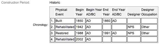
Barn (1850-1860) is a two-story brick and frame Pennsylvania bank barn on a granite foundation that measures 80.0 x 64.0 feet with a 6.0 x 15.0 feet lean-to used as a wagon shed and corn crib on the south side. Diamond-shaped hay stack/corn shock vents are located in the north and south gable ends. On the east side there is an earthen ramp flanked on each side by two brick granary sheds. A cantilevered forebay with vertical wood siding extends the full length of the eastern side. The rooflines of the granary extensions on the west balance each other out to form a symmetrical gable. The gable roof has three types of wood shingles.
My Sources
1.
NRHP Nomination Form
2.
Stone Sentinels
3.
Draw the Sword
5.
Civil War Wiki
6.
Gettysburg Times
7.
ancestry.com
8.
Visit Pa