Sixth Crossing Mill Creek - 1930 - Marion County, Oregon
Posted by: Groundspeak Regular Member ddtfamily
N 44° 50.320 W 122° 54.485
10T E 507264 N 4965032
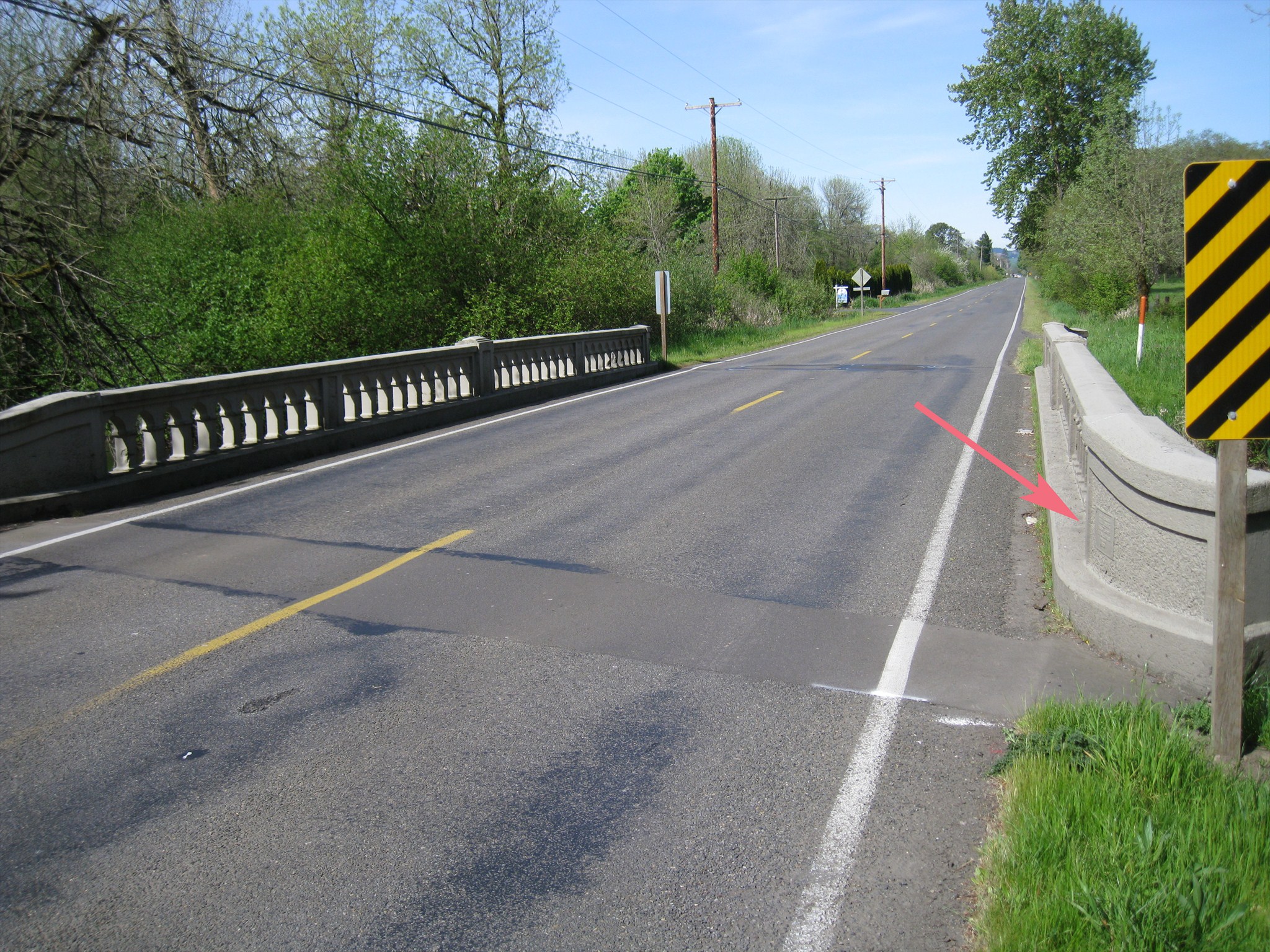
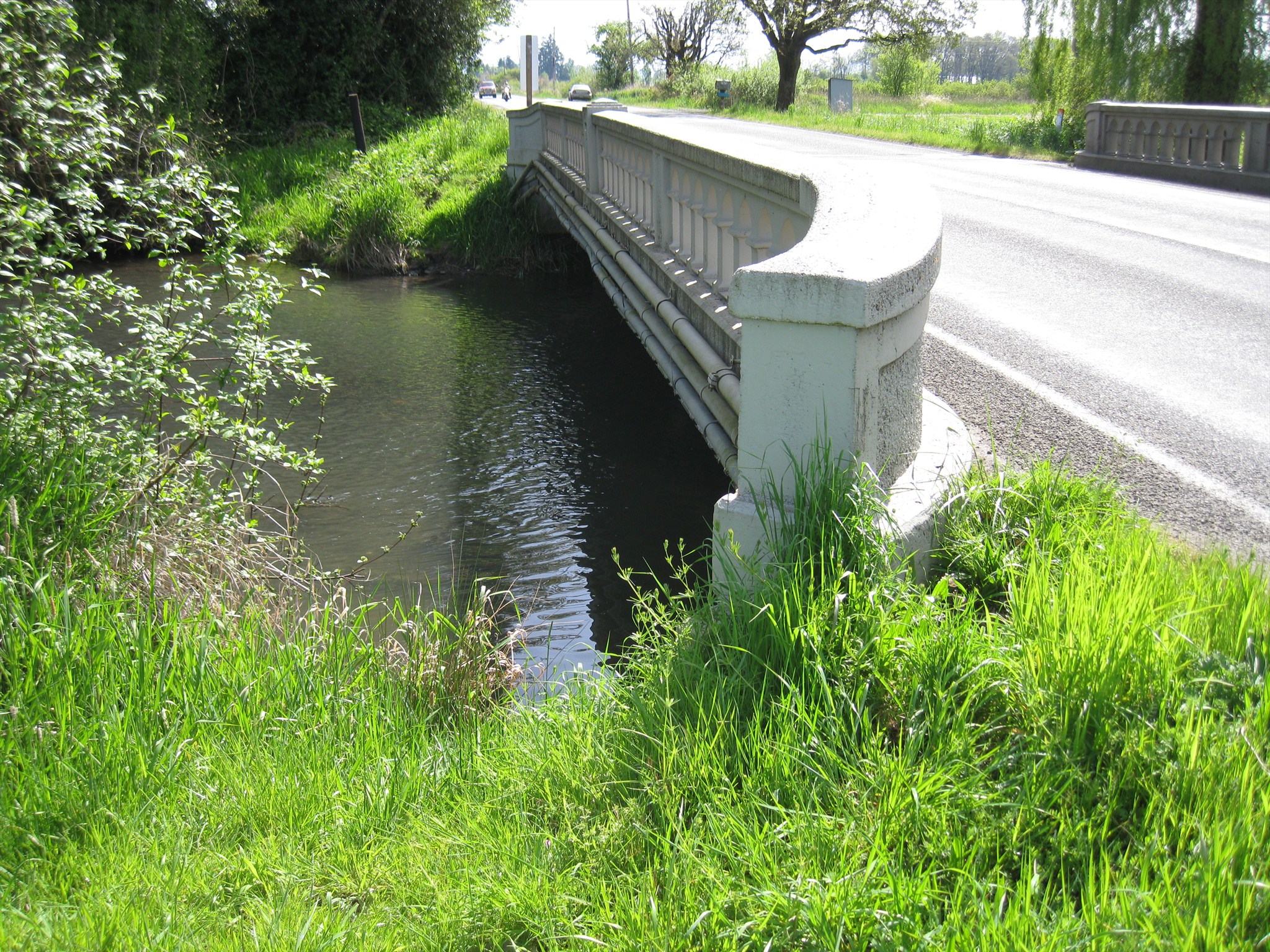
One of several similar bridges over Mill Creek on Mill Creek Road
Waymark Code: WMGZA5
Location: Oregon, United States
Date Posted: 04/27/2013
Published By:Groundspeak Premium Member Jake39
Views: 2

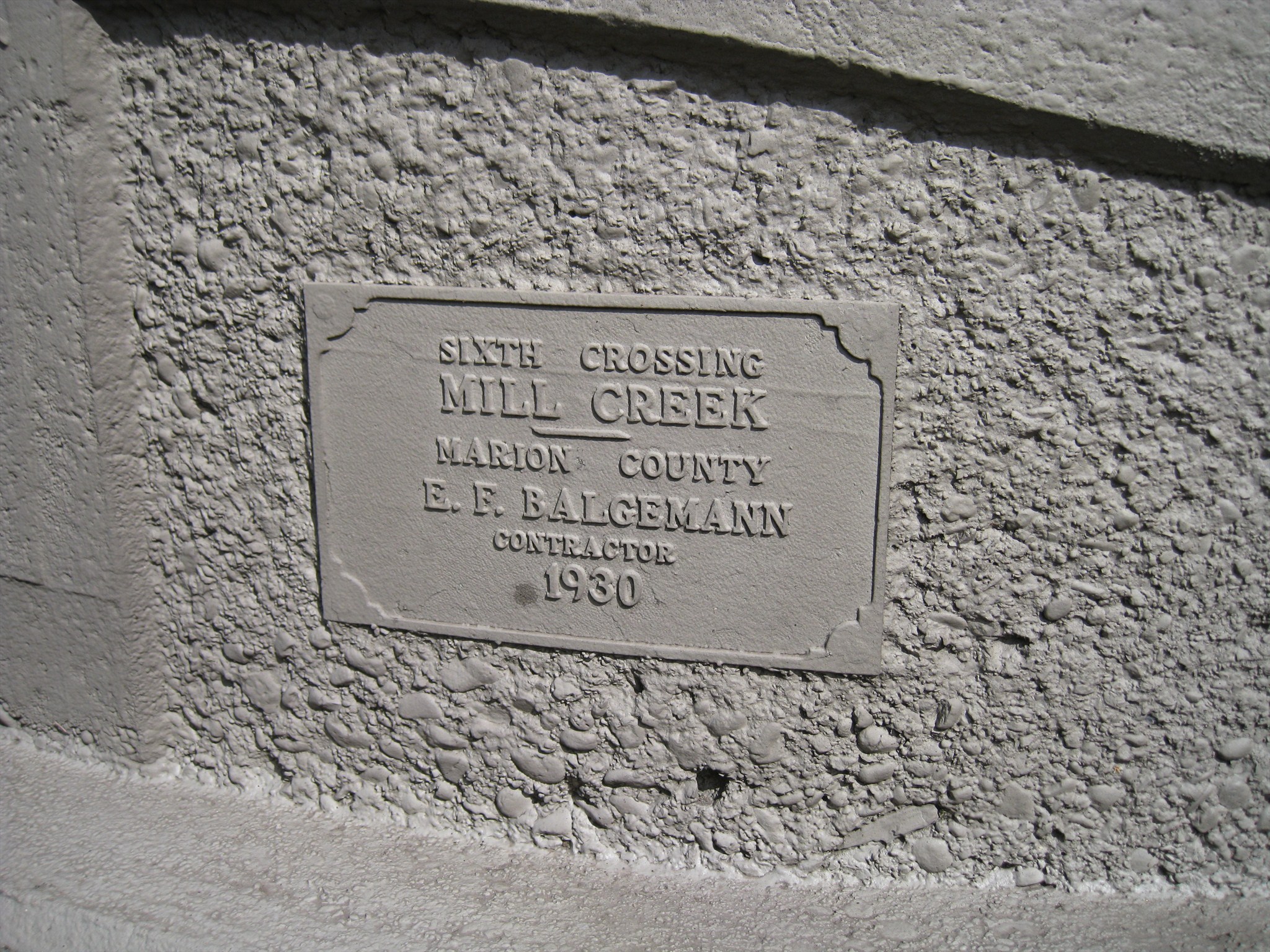
This short bridge measures 61 feet in length and is one of several that span Mill Creek east of the town of Turner, each of which are nearly identical. The bridge was built in 1930 and contains two identical dedication plaques - embedded in the wall near each end of the bridge. The marker text says:

SIXTH CROSSING
MILL CREEK
___

MARION COUNTY
E. F. BALGEMANN
CONTRACTOR
1930

The only halfway reasonable parking options are on the shoulders near the driveways east and west of the bridge.

Click a photo to enlarge

Date built or dedicated as indicated on the date stone or plaque.: 1930

Date stone, plaque location.: The bridge contains two identical plaques: one at the west end of the south wall, one at the east end of the north wall

Road, body of water, land feature, etc. that the bridge spans.: Mill Creek

Parking (safe parking location): N 44° 50.320 W 122° 54.539

Website (if available): Not listed

Visit Instructions:
Please provide an original picture of the location and some original words regarding your visit.
Search for...
Geocaching.com Google Map
Google Maps
MapQuest
Bing Maps
Nearest Waymarks
Nearest Bridge Date Stones and Plaques
Nearest Geocaches
Create a scavenger hunt using this waymark as the center point
Recent Visits/Logs:
There are no logs for this waymark yet.