
ORIGIN: Shoal Creek, Southwest Missouri
N 36° 39.443 W 093° 57.304
15S E 414640 N 4057290
Shoal Creek is a historic creek that attains river stature after flowing through 3 counties, crossing from Missouri to Kansas
Waymark Code: WMGK9V
Location: Missouri, United States
Date Posted: 03/15/2013
Views: 17
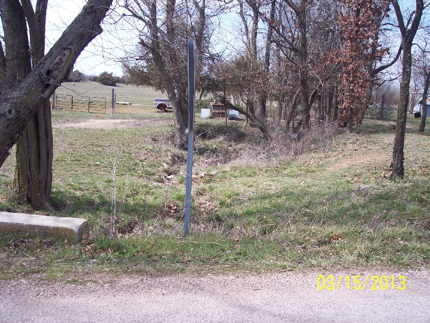
From this:
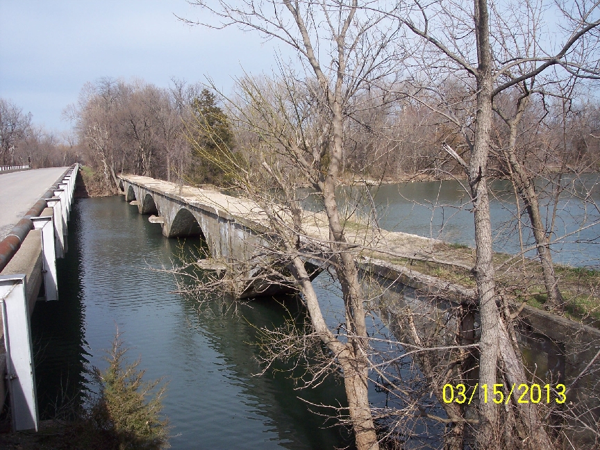
to this:
Shoal Creek is mentioned often in accounts of the Civil War in Southwest Missouri - the state with the third highest number of Civil War encounters. A Shoal Creek encounter can be found at this Ozarks Civil War website. Shoal Creek has its own Wikipedia page, which has a glaring error: Shoal Creek never touches Jasper County!
All of my pictures were taken on the same day, so that the water level can be compared at various locations along the creek. The Garmin topographic map for my GPS shows Shoal creek starting at about N36°38.871', W093°57.709'; but that is a misinterpretation of aerial photographs, since a visit to this area (on Robbins Road) shows the line on the topo to be a tree line (old fence line) that is not even in a depression. Actual following of the creek ends up at the coordinates that I have given.
The final confluence of Shoal Creek into the Spring River is on private land, but the approximate coordinates for that confluence are N37°03.668', W094°43.169' from a topo map. It can easily be seen from satellite photographs. (Don't confuse this creek with the one near Kansas City. That is a different Shoal Creek.)