
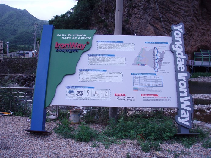
Yongdae Iron Way (용대 아이언 웨이) - Inje, Korea
Posted by:  silverquill
N 38° 13.281 E 128° 22.084
52S E 444685 N 4230563
This site is located in the rugged mountains near Soraksan National Park in northeastern Korea. There are two pegged course here, and an artificial waterfall is activated in the fall to provide challenging ice climbing.
Waymark Code: WMG5M4
Location: Gangwondo, South Korea
Date Posted: 01/15/2013
Views: 4
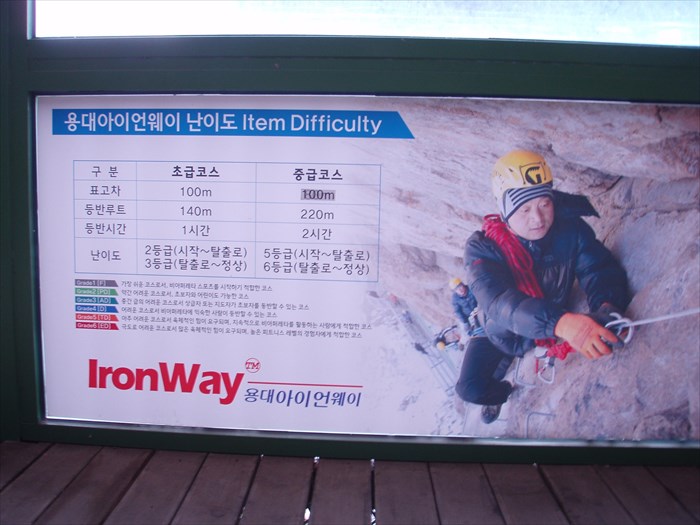
This is an Iron Way, or Via Ferrata, climbing course which is characterized by fixed iron rungs on the rock face. There are two courses laid out here, one labeled "Easy" and one labeled "Medium." They take either one hour or two hours according to the guides.
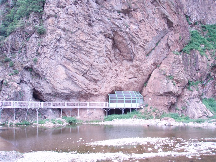
There is a walkway leading from the highway along the edge of the river to a cave built into the base of the rock. This provides an enclosed staging area and even a small lecture hall. Both course begin at this point.
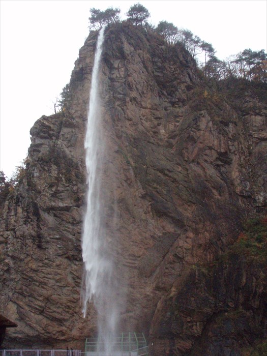
Although there is good climbing hear all year, this site has gained special note as a challenging ice climbing site which is created by an artificial waterfall. The water is piped to the top of the 387m (1,270 feet) rock and turned on in the fall to create a spectacular ice wall.
This rock is called Maebawi although it is apparently also call Chang Rock for its resemblance to a spear. It is located at the junction of Routes 46 and 56, and there are motels and other tourist facilities at this location.