
The Gettysburg National Park Commission [The Commission is also referred to as the Gettysburg National Military Park Commission or the Gettysburg Park Commission], established by the United States Department of War, after they took over the administration of the park from the Gettysburg Battlefield Memorial Association (whose funds had expired) on March 3, 1893, and whose stewardship was later transferred to the National Park Service in 1933 (SOURCE), took a pictorial inventory of many of the existing monuments in the eventual historic district (a majority of them seem to have been Pennsylvania monuments being there are over one hundred of them). These pictures were included in their yearly Commission reports. I have found hundreds of these pictures on Virtual Gettysburg, a comprehensive website which pictorially inventories all the monuments and provides minor narratives as well. All the photos look the same as if they were taken by the same camera and in the same approximate time period. Even the angles are all the same, positioning the monument at a slight right angle (standing to the left), revealing a little of the left side of the monument. The entire park looks so young and immature when the photos were taken. After all, the Battle of Gettysburg was thirty-seven years old at the time and war veterans were only in their fifties. I have never been able to find any photo credits (I have a sneaking suspicion some of the photos may have been snapped by members of the Park Commissions and published in their annual November report to the War Department) but I know they are public domain because their copyrights have all expired. This picture represent the efforts of the Commission well into the Commission period. Most of my pictures I use come from a website called Virtual Gettysburg. It seems however, all the pictures of the New York monuments were either borrowed from or shared with a New York monuments website. That site, The New York State Division of Military & Naval Affairs can be found HERE. This picture was on the Virtual Gettysburg site and can be found HERE.
Clearly it is evident, through a survey of historical pictures and other archival information (such as the annual Commission reports), much change has occurred at Gettysburg Battlefield. With the passage of legislation affording historical status to this site as well as placing it under the auspices of the National Park Service, its patrons and caretakers had to groom and prepare the area to make it more authentic as well as educational. Today the battlefield has managed to maintain an authentic 1863 feel, but back then, as evident in the many photos, it was a desolate, empty place of brown and green fields broken only by the occasional farmstead, their outbuildings and fields of crops. With the emergence and dedication of hundreds of monuments during the commemoration period and all the other dedications prior to 1900, and the development of farmland, some change has occurred but for the most part, nothing too dramatic. I believe this monument was taken in the early 1900s as other pictures from surrounding monuments were taken in the same era and look similar. As far as differences in the two pictures, everything with the monument is the same and the background, including the fence, is also similar. A few trees have grown but that is all the change which has occurred in the last 110 years.
The position marker is located on the west or left side of Hancock Avenue if traveling north, just past the Pennsylvania State Monument, located on the west or left side of the road, northwest of the Pennsylvania Monument. The 9th Michigan Battery Monument is just to the left of this marker. The Pleasanton Avenue intersection is just north of this position. The front inscription faces the east, so you would be facing the west to read it. This location is a hot-bed of activity and one of the best examples of a hands-on history lesson of the Civil War one could hope to find. All along both sides of the road are these types of tablets, memorials, monuments, sculptures, and all manner of cannons, rifles and guns. Parking is available at enlarged shoulder cutouts on the right side of the road, directly across from the various monuments. Be sure to keep vehicles off the grass or you will be ticketed by park police. I visited this monument on Thursday, July 5, 2012 just before 6:00 P.M. I was at an elevation of 575 feet, ASL. I used a Canon PowerShot 14.1 Megapixel, SX210 IS digital camera for the photos. I faced west northwest to get my matching photo, placing the monument at the slightest of angles, revealing a smidgeon of the left side.
From a previous waymark about this monument:
This monument is considered a position marker for this regiment, secondary to the primary 17th Maine Infantry Monument. There are two types of Civil War position markers, those that are larger and significant enough to have their own NRHP listing and SIRIS listing and this type, which are considered insignificant and have neither. It is surprising this did not get recognition as it is an elaborate monument as far as these thing go.
The 17th Maine Infantry served as a member of De Trobriand’s Brigade in Birney’s Division of the Third Corps, Army of the Potomac, a Fighting 300 Regiment. The regiment was commanded by Lieutenant Colonel Benjamin Merrill (1827-1891), a graduate of Havard Law School (1849) and a lawyer in Portland either before and/or after the war. Under Merrill's command, the 17th Maine brought 292 men to the Gettysburg Battlefield and among them, 18 were killed, 112 were wounded and 3 went missing.
The monument can be described as a diamond-shaped sculpture with a square bottom standing on a low, rough-hewn base. The edges of the sculpture are also rough-hewn. There is a pink diamond with a polished surface set into the front face of the monument. The sculpture marks the July 3 position of the regiment in support of the 9th Michigan Artillery. The NRHP has the dimensions listed as: base: 4 feet 6 inches x 3 feet 2 inches; height: 6 feet. The front of the granite monument (faces the east) has an incised inscription under the red diamond (at the bottom) which reads:
 Position of 17th Maine Infty. July 3, 1863.
Losing here killed 2. Wounded 10.
This regt. fought July 2 in the Wheatfield
as shown by monument there losing 120.
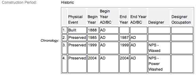
The 17th Maine Infantry Position Marker, monument and flank markers are all contributing features to the Gettysburg National Military Park Historic District which is nationally significant under NR Criteria A, B, C & D. Areas of Significance: Military, Politics/Government, Landscape Architecture, Conservation, Archeology-Historic. Period of Significance: 1863-1938. The original National Register Nomination was approved by the Keeper March 19, 1975. An update to this nomination was approved by the Keeper on January 23, 2004. Collectively, they are identified as structure number MN150-C.
From the Nomination Form:
Marks position held by 17th Maine Infantry during afternoon of July 2, 1863. 1 of 15 mns in Park to Maine troops at Gettysburg. Monument located on the south end of Wheatfield on DeTrobriand Avenue. The July 3, 1863, position marker is located on the west side Hancock Avenue, northwest of the Pennsylvania Monument.
Short Physical Description:
Mn, 2 flank markers, 1 position marker. Base, 8'x8'x2'3". Granite shaft 4'3" sq. w/ alternating smooth & rough courses topped w/ sculpted infantryman behing stone wall. Shaft Inscriptions & bronze inscrpt. tablet. Flank markers, slant faced, 1'6"x1'x2'. Position marker, base 4'6"x3'2", 6' h.
Long Physical Description:
Monument that has two flanking markers and one position marker. Monument is a 4.3 foot square granite shaft with alternating smooth and rough courses topped with a sculptured infantryman behind a stone wall and set on a 8.8x2.3 foot base. The shaft has inscriptions and a bronze inscription tablet. The flanking markers have slanted faces and are 1.6x1 foot. The position marker is six foot high on a 4.6x3.2 foot base. Monument is located at the south end of the Wheatfield on DeTrobriand Avenue. The position marker is located on the east side of Hancock Avenue.
Sources:
1.
NRHP Nomination Form
2.
Stone Sentinels
3.
Virtual Gettysburg
4.
Draw the Sword
5.
Historical Marker Database