Bodie Island Lighthouse, North Carolina
Posted by:  showbizkid
N 35° 49.096 W 075° 33.785
18S E 449134 N 3963938
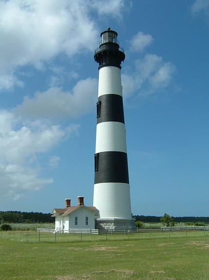
Bodie Island Light Station is operated by the National Parks Service, having taken over for the Coast Guard a few years ago. The present lighthouse is the third on the site. The first was poorly constructed and the second destroyed by the Confederates during the Civil War. The present lighthouse was built in 1872.
Waymark Code: WMFNP
Location: North Carolina, United States
Date Posted: 06/26/2006
Views: 54
Bodie Island (pronounced "body") is north of Hatteras, 2 miles north of the bridge over Oregon Inlet. The light station grounds are freely accessible. The keepers house has been renovated as a visitor's center. The tower is currently undergoing renovations and is closed to the public. The National Parks Service now operates the site.
A light was first authorized by Congress for this site in 1837, but the first ill-fated light was not built until 10 years later. The tower was only 54 feet in height, but poor construction on unstable ground caused it to tilt out of plumb almost immediately. In 1859 a second tower, this time 80 feet tall, was constructed with a firm foundation and fitted with a third-order lens. Luck was against Bodie again--two years later Confederate troops destroyed the tower with explosives.
The current tower was erected in 1872, and is a twin of the Corolla light, except for it's horizontal striped markings. It stands 156 feet above the sands and still shines through the original first-order Fresnel lens. Bad luck did attempt another visit, however, when soon after the first lighting a flock of geese crashed into the lantern and badly damaged the expensive lens. Repairs were made, and Bodie Island Light has stood ever since.
For those interested in the specifics of the light station, NPS has a brief Facts Sheet on the Bodie Light Station.
The visitors center is open every day from 9 am to 6 pm. Posted coordinates will take you to the closest point possible to the tower as of 6/2006 - perhaps 50 feet or so.
To record your own visit to this waymark, take and post your own original photo of the waymark, and upload it with your log. Logs must contain the required photo as proof of your visit, please