
Yeongam Geumho Seawall Completion Monument (영암 금호방조제 준공탑) - Yeongam, Korea
Posted by:  silverquill
N 34° 43.227 E 126° 23.198
52S E 260688 N 3845152
This column is a monument commemorating the building of the Yeongam Geumho Seawall, part of a project that was started in 1972.
Waymark Code: WMEDBX
Location: Jeolla nam do, South Korea
Date Posted: 05/11/2012
Views: 2
This granite column I estimate to be about 60 feet high. The monument name is inscribed vertically on the front and two sculptures flank the column, one honoring the construction workers, the other depicting farmers who benefited so much from the project. The date inscription of Nov. 6, 1996, is accompanied by the name of Presiding Kim, Young-sam, the president of Korea. Another inscription identifies the designers as Park, Chan-geuk and Ji, Gwang-myeong.
(Click on any picture for a larger image)
This map and information board is at the base of a small hill where on impressive, towering granite monument to the construction of this seawall is located. The climb up the steps to the monument yields fantastic panoramic views of the river and estuary and the ongoing construction projects.
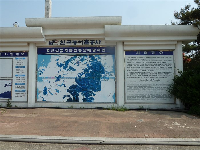
An Outline of Projects
The basin area of Youngsan river which runs 137km from Mount Chuwal in Dam Yang to an estuary dam in MokPo exceeds 347,000ha through twelve cities and towns.
YoungSan River flows through the biggest breadbasket whose farmland has the highest rate among major four rivers in Korea. However, there is a lack of irrigation facilities and habitual drought and flood disasters which are repeated due to the geographical features that have resulted in the obstacle to community development.
In order to resolve such disasters and vicious circles fundamentally, the government established the agricultural comprehensive development project along the banks of the YoungSan River. The government began to introduce the first project in 1972 and constructed great lakes on the upper Young-San in Danyang, Jangsung, KwangJu and Naju, which turned 34,500ha farmland into all-weather crop land. It also continued to erect Young-san bank in the mouth of the river as a second project so that 20,700ha land was changed into the superior farmland in 1981. The third project was the completion of Youngam, Kumho tide embankment. It created 21,000ha farmland nearby.
The agricultural comprehensive development projects near Young-San river basin have been conducted to develop water resources extensively, which are used to flow straightly into the sea. It has resulted in acquiring not only agricultural water but also industrial water and water for everyday use. Moreover, it provides superior farmland, industrial land, and housing for cities due to land development. Lastly, It has laid the groundwork for the southwest development such as industrial belts connecting from one city to another. It also has attracted more customers with better conditions in the tourist industry since more efficient ground transportation has appeared and therefore, it will contribute to the balanced land development in Korea.