
Charyeong Uphill Road Cheonan-Gongju crossing
Posted by:  silverquill
N 36° 39.149 E 127° 07.491
52S E 332391 N 4057959
Located at the historic Charyeong Pass, on old Route 23, this boundary between the cities of Cheonan and Gongju is marked with these welcome and good-bye signs. The road is infrequently used as the new Expressway bypasses the pass with a tunnel.
Waymark Code: WMEADY
Location: Chungcheong nam do, South Korea
Date Posted: 04/27/2012
Views: 3
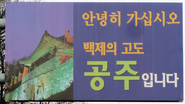
This sign depicts a photograph of a portion of the old palace of the Baekje Kingdom in the city of Gongju.
Gongju takes great pride in its history as the capital of the Baekje Kingdom from AD 475 to 538. In 538, King Seong moved the capital to Sabi in what is now Buyeo, but remaining a significant center of power and culture until the fall of the Baekje Kingdom in 660.
Recent archaeological work has been able to restore some of the historic sites, such as this portion of the palace, and there is a National Museum in Gongju with many important artifacts and displays depicting the history of Baekje.
National Highway 23 was a major north-south route until the new Expressway IC-25 was completed, using a tunnel through the mountain instead of this overland route. The pass was a historic passage way from Seoul, through the city of Cheonan and south to the Honam District (the North and South Jeolla provinces). At 360 meters, it was the highest pass on the route.
There is an abandoned and largely demolished rest area at this site, but the historic markers and signs are still intact.